


The neighborhood of Montrose in Houston has undertaken a self-funded study to assess the facts on the ground about walkability in the neighborhood.
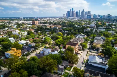
"In Montrose [Houston], despite being considered one of the most walkable areas in the city, almost 30% of the sidewalks are in poor condition, rendering 6 out of every 10 blocks potentially impassable to someone in a wheelchair or pushing a stroller," reports Matt Dullin.
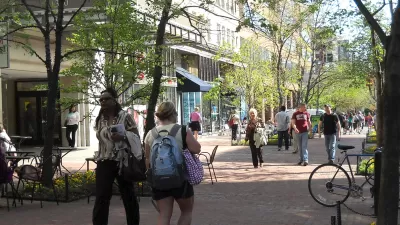
Dullin is sharing findings from "a nine-month, first-of-its-kind study backed by the Montrose Tax-Increment Reinvestment Zone," which charts a path to new levels of walkability and pedestrian friendliness in the neighborhood. The goal is the "20-minute neighborhood" that is becoming a more popular idea in some U.S. cities.
"The plan outlines a road map to make Montrose a '20-minute neighborhood,' where a high quality of life is possible for residents without ever having to hop into a car, said Geoff Carleton, senior principal for Traffic Engineers Inc., which led the study with Gauge Engineering," as reported by the article.
"The study identifies over $40 million in potential projects, most of which will involve partnerships between the TIRZ, the Metropolitan Transit Authority of Harris County, the city of Houston and Harris County. The study also contemplates other programs to encourage homeowners and developers to make sidewalk improvements with the possibility of rebates," adds Dullin for more detail.
The news about Montrose's efforts to plan a more walkable neighborhood is supplemented by the big news that the entire city of Houston adopted this week an ambitious plan for new development in parts of the city to devote more priority to pedestrians, and spend less effort devoted to the car-centric plans of the past.
Unlike much of the city of Houston, Montrose has a reputation as a pedestrian-friendly. Local stakeholders and experts cited by Dullin, however, say that the state of repair of the sidewalks in the neighborhood render much of the neighborhood's pedestrian infrastructure as useless for many users.
FULL STORY: Walk/bike study lays out path for Montrose to become ‘20-minute neighborhood’

Cities Seeking '20-Minute Living'
Reducing car dependency can improve air quality, increase access to jobs and opportunities, and help cities meet emissions reduction goals.

From Paris to Portland: The 15-Minute City Goes Mainstream
Raising the bar on the 20-minute neighborhood model, cities around the world are embracing the appeal of the 15-minute city during the coronavirus pandemic.
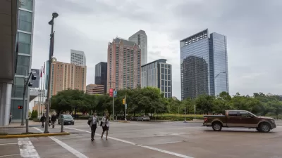
Walkability Plan, Including Parking Reform, Adopted in Houston
The city of Houston is embarking on an ambitious plan to reshape how new development in the city prioritizes walkability, and deprioritizes the automobile.

Planetizen Federal Action Tracker
A weekly monitor of how Trump’s orders and actions are impacting planners and planning in America.

San Francisco's School District Spent $105M To Build Affordable Housing for Teachers — And That's Just the Beginning
SFUSD joins a growing list of school districts using their land holdings to address housing affordability challenges faced by their own employees.

The Tiny, Adorable $7,000 Car Turning Japan Onto EVs
The single seat Mibot charges from a regular plug as quickly as an iPad, and is about half the price of an average EV.

Trump Approves Futuristic Automated Texas-Mexico Cargo Corridor
The project could remove tens of thousands of commercial trucks from roadways.

Austin's First Single Stair Apartment Building is Officially Underway
Eliminating the requirement for two staircases in multi-story residential buildings lets developers use smaller lots and more flexible designs to create denser housing.

Atlanta Bus System Redesign Will Nearly Triple Access
MARTA's Next Gen Bus Network will retool over 100 bus routes, expand frequent service.
Urban Design for Planners 1: Software Tools
This six-course series explores essential urban design concepts using open source software and equips planners with the tools they need to participate fully in the urban design process.
Planning for Universal Design
Learn the tools for implementing Universal Design in planning regulations.
Smith Gee Studio
City of Charlotte
City of Camden Redevelopment Agency
City of Astoria
Transportation Research & Education Center (TREC) at Portland State University
US High Speed Rail Association
City of Camden Redevelopment Agency
Municipality of Princeton (NJ)