


Reducing car dependency can improve air quality, increase access to jobs and opportunities, and help cities meet emissions reduction goals.
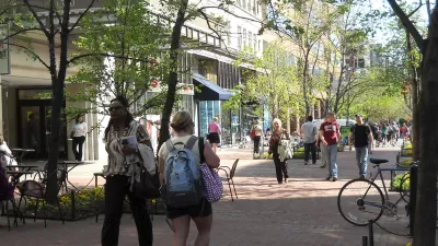
Like other cities around the country, Eugene, Oregon is "pushing several initiatives to promote '20-minute living,' the ability to reach important destinations like grocery stores and workplaces within that time frame." As reported by Haisten Willis in the Washington Post, city leaders want to make 90% of Eugene "20-minute friendly" by 2030, a goal that supporters say will improve air quality and resident health, raise property values, and reduce transportation costs.
Terri Harding, Eugene's principal planner for long-range planning, calls compact development and 20-minute neighborhoods the "pillars of growth management" for the city. The city's downtown, as a cultural and civic hub, is already a "gold-star 20-minute neighborhood," but "enhancing walkability farther out will be challenging."
Improving access isn't just about promoting biking and walking and enhancing transit. "Making cities more walkable involves creating a more compact footprint, where more businesses are built near existing homes. But it also means building housing near existing businesses, such as stores and restaurants." As deeply intertwined issues, transportation and land use must be approached simultaneously. "While the term '20-minute neighborhood' seems to refer primarily to transportation, it also speaks to land use. Planning and zoning are major factors as well, with more mixed-use and infill development needed to realize the vision."
FULL STORY: See you in 20 (or less): Living where access is within a short walk or bike ride

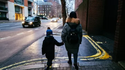
London Low-Emissions Zone Prompts Shift to Active Modes
More children are using active transportation modes to get to school in the wake of a policy that charges drivers to enter a low-emissions zone in central London.
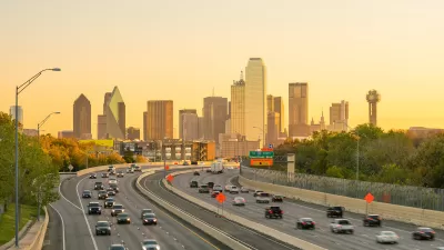
How to Reduce Excess Vehicle Travel
Some experts claim that remote work is the most effective way to reduce vehicle travel, but my research indicates that improving and encouraging walking, bicycling, and public transit can provide larger impacts and benefits.

Partisan Splits for Transportation Politics
Researchers found that while left-leaning respondents were more likely to favor transportation reform and sustainable modes, conservatives are not as far behind as we think.

Maui's Vacation Rental Debate Turns Ugly
Verbal attacks, misinformation campaigns and fistfights plague a high-stakes debate to convert thousands of vacation rentals into long-term housing.

Planetizen Federal Action Tracker
A weekly monitor of how Trump’s orders and actions are impacting planners and planning in America.

In Urban Planning, AI Prompting Could be the New Design Thinking
Creativity has long been key to great urban design. What if we see AI as our new creative partner?

King County Supportive Housing Program Offers Hope for Unhoused Residents
The county is taking a ‘Housing First’ approach that prioritizes getting people into housing, then offering wraparound supportive services.

Researchers Use AI to Get Clearer Picture of US Housing
Analysts are using artificial intelligence to supercharge their research by allowing them to comb through data faster. Though these AI tools can be error prone, they save time and housing researchers are optimistic about the future.

Making Shared Micromobility More Inclusive
Cities and shared mobility system operators can do more to include people with disabilities in planning and operations, per a new report.
Urban Design for Planners 1: Software Tools
This six-course series explores essential urban design concepts using open source software and equips planners with the tools they need to participate fully in the urban design process.
Planning for Universal Design
Learn the tools for implementing Universal Design in planning regulations.
planning NEXT
Appalachian Highlands Housing Partners
Mpact (founded as Rail~Volution)
City of Camden Redevelopment Agency
City of Astoria
City of Portland
City of Laramie