


The city of Houston is embarking on an ambitious plan to reshape how new development in the city prioritizes walkability, and deprioritizes the automobile.
Dylan McGuinness reports from Houston, where the city has approved a new plan to encourage more walkabiluty, and less reliance on cars, in the city.
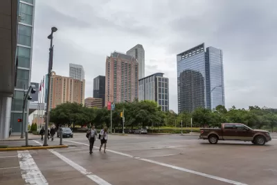
The Houston City Council voted unanimously on Wednesday "on a slate of ordinances that would bring buildings closer to the street, force parking lots to the side or behind buildings, expand sidewalks, and require 'buffer' zones between sidewalks and the road. The ordinances would apply to new buildings and redevelopment only in certain parts of the city," reports McGuinness.
"The ordinances would create two distinct programs: areas with a “Walkable Places” designation, where the city seeks to foster pedestrian-friendly development; and areas in the “Transit-Oriented Development” Program, where the city hopes to bring the same principles to most streets that fall within a half-mile of a bus or train station."
The latter of those two programs contains a slew of planning reforms, including parking reforms, that will pique the interest of many progressive-minded planners:
For the streets covered by either program, the plan would undo many of the car-centered rules adopted in the 1990s. For example, under those rules, all development on major streets must be set back 25 feet from the road, which results in parking lots facing the streets. Businesses, whether they are in Midtown or Meyerland, must offer a prescribed number of parking spaces for customers. And sidewalks must be 5 feet wide.
The new rules would waive the set-back requirement, bringing buildings closer to the road, and force parking lots to the side or behind new buildings. The transit-oriented development ordinance would cut or eliminate the number of parking spaces developments must provide, depending on the street.
McGuinness includes soundbites from James Llamas, a transportation engineer who served on the committee that drafted the plan, Bill Fulton, director of Rice University’s Kinder Institute for Urban Research, and Margaret Wallace Brown, the city’s planning director, for local insight into the significance of the city's new approach to walkability.
FULL STORY: Houston considers plan that could mean more 'walkable' neighborhoods, less reliance on cars


Europe Building a Post-Car Future
While the United States mobilizes to transition to electric cars, cities and countries in Europe are transitioning to fewer cars.

A Freeway Rebellion Rises in the Unlikeliest of States: Texas
“There’s no train, there’s no bus, there’s no anything that supports mass transportation. It doesn’t exist.” -Houston resident Fabian Ramirez.

Year in Review: Urban Planning in 2021
Part one of two of Planetizen's review of 2021—re-assessing failed predictions and daylighting the biggest planning stories of the year.

Maui's Vacation Rental Debate Turns Ugly
Verbal attacks, misinformation campaigns and fistfights plague a high-stakes debate to convert thousands of vacation rentals into long-term housing.

Planetizen Federal Action Tracker
A weekly monitor of how Trump’s orders and actions are impacting planners and planning in America.

San Francisco Suspends Traffic Calming Amidst Record Deaths
Citing “a challenging fiscal landscape,” the city will cease the program on the heels of 42 traffic deaths, including 24 pedestrians.

Half of Post-Fire Altadena Home Sales Were to Corporations
Large investors are quietly buying up dozens of properties in Altadena, California, where a devastating wildfire destroyed more than 6,000 homes in January.

Opinion: What San Francisco’s Proposed ‘Family Zoning’ Could Really Mean
Mayor Lurie is using ‘family zoning’ to encourage denser development and upzoning — but could the concept actually foster community and more human-scale public spaces?

Jacksonville Launches First Autonomous Transit Shuttle in US
A fleet of 14 fully autonomous vehicles will serve a 3.5-mile downtown Jacksonville route with 12 stops.
Urban Design for Planners 1: Software Tools
This six-course series explores essential urban design concepts using open source software and equips planners with the tools they need to participate fully in the urban design process.
Planning for Universal Design
Learn the tools for implementing Universal Design in planning regulations.
Gallatin County Department of Planning & Community Development
Heyer Gruel & Associates PA
JM Goldson LLC
City of Camden Redevelopment Agency
City of Astoria
Transportation Research & Education Center (TREC) at Portland State University
Jefferson Parish Government
Camden Redevelopment Agency
City of Claremont