


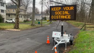
Early in the pandemic, bike sales soared and vehicle miles traveled plummeted. As people have been driving more, more people have also been infected with the novel coronavirus.

Andy Olin provides a really thorough overview of the mobility trends in the United States since the outset of the COVID-19 pandemic in March.
The narrative is summarized thusly:
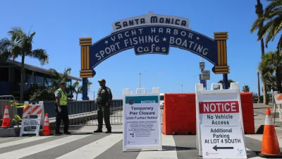
Traffic levels fell dramatically throughout the Houston metro area as people were ordered to stay at home and businesses were closed to mitigate the spread of COVID-19 — and it worked. But, as the economy was reopened and people returned to work, restaurants, bars, beaches and more, traffic levels and infection rates increased.
The article includes a mountain of data on bike sales and use, traffic and vehicle miles traveled, and air quality, providing specific examples from around the country and the nation as a whole, before drilling down on air quality data in the Houston area. Much of the information in the article has been reported before in separate media outlets and news coverage, but here we have all the relevant data in one place, clearly put in context and analyzed for potential implications.
But the article also includes a bombshell revelation that could potentially upend the ongoing narrative about density and transit being the most conductive modes for transmission of the coronavirus: when people drive more, more people are infected with the coronavirus.
FULL STORY: Traffic dropped 66%, but it came back and the coronavirus followed

How COVID-19 Impacted Mobility in California
Analysis of cell phone location tracking data shows changes in how Californians have moved around since the pandemic.

Ride-Hailing Companies Have Yet to Recover
While public transit tends to make the most headlines for coronavirus-damaged ridership numbers, ride-hailing companies like Uber and Lyft aren't exactly raking in new customers.
Greenhouse Gas Emissions Reduced 17% Worldwide in April, Study Says
A recently published study predicts a 4 to 7 percent decline in greenhouse gas emissions for 2020 compared to 2019.

Maui's Vacation Rental Debate Turns Ugly
Verbal attacks, misinformation campaigns and fistfights plague a high-stakes debate to convert thousands of vacation rentals into long-term housing.

Planetizen Federal Action Tracker
A weekly monitor of how Trump’s orders and actions are impacting planners and planning in America.

In Urban Planning, AI Prompting Could be the New Design Thinking
Creativity has long been key to great urban design. What if we see AI as our new creative partner?

Chicago’s Ghost Rails
Just beneath the surface of the modern city lie the remnants of its expansive early 20th-century streetcar system.

Baker Creek Pavilion: Blending Nature and Architecture in Knoxville
Knoxville’s urban wilderness planning initiative unveils the "Baker Creek Pavilion" to increase the city's access to green spaces.

Pedestrian Deaths Drop, Remain Twice as High as in 2009
Fatalities declined by 4 percent in 2024, but the U.S. is still nowhere close to ‘Vision Zero.’
Urban Design for Planners 1: Software Tools
This six-course series explores essential urban design concepts using open source software and equips planners with the tools they need to participate fully in the urban design process.
Planning for Universal Design
Learn the tools for implementing Universal Design in planning regulations.
planning NEXT
Appalachian Highlands Housing Partners
Mpact (founded as Rail~Volution)
City of Camden Redevelopment Agency
City of Astoria
City of Portland
City of Laramie