


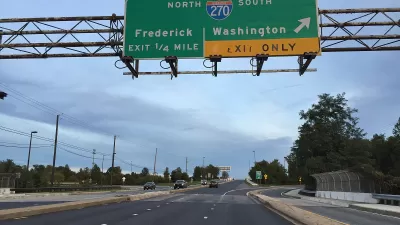
A plan to widen Interstate 270 in Maryland was approved earlier this year under the condition that the state also study a plan to build a monorail along the route.
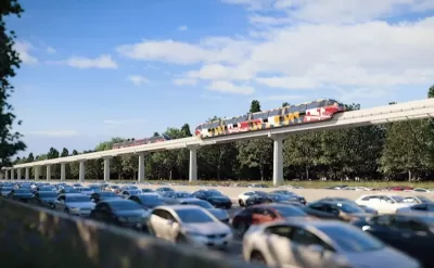
Dan Malouf writes: "Maryland will officially study a proposal to build a monorail along I-270, from Shady Grove to Frederick. Let’s examine whether that’s a crazy idea, or if monorail is a legitimate and practical possibility."
As noted by Malouf, the monorail feasibility plan is a component of a larger plan to widen I-270, approved by the Maryland Public Works Board in June 2019.
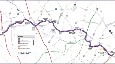
"If built, the foundation’s plan would see a 27-mile monorail, mostly along I-270, with six stops: Frederick, Urbana, Comsat (Clarksburg), Germantown, Metropolitan Grove, and Shady Grove. They say the elevated monorail would take 31 minutes to get from Frederick to Shady Grove, carry between 39,000 and 55,000 riders per day, and cost around $3.4 billion to build," explains Malouf.
Malouf digs into the strengths (e.g., lighter, cheaper, and aesthetic above ground) and weaknesses (e.g., must be elevated, can't switch tracks, potentially more expensive).
The High Road Foundation, the advocates behind the proposal, "seem most keen to provide a direct transit connection between Frederick and Montgomery County, according to Malouf, so the article also considers the potential of other modes (e.g., bus rapid transit, Metro rail, light rail, Diesel Multiple Units) to meet the need.
FULL STORY: Is a monorail on I-270 in Maryland a crazy idea? Here are its legit pros & cons

Study: Montgomery County Needs Dedicated Bus Lanes, Rail Extension
A report from Montgomery County planners prioritizes the need for a robust network of bus lanes and the extension of the Red Line to accommodate the region's growing population and reduce car trips and congestion.
Maryland's Purple Line Clears Final Legal Obstacle
A third lawsuit tried to halt the Purple Line light rail project in Maryland, but it was just the latest lawsuit to get tossed by a judge.
Maryland Toll Lane Plan Gains Federal Approval
In a victory for Governor Larry Hogan, who has championed the project, the Federal Highway Administration is allowing the Beltway expansion project to move ahead.

Planetizen Federal Action Tracker
A weekly monitor of how Trump’s orders and actions are impacting planners and planning in America.

Congressman Proposes Bill to Rename DC Metro “Trump Train”
The Make Autorail Great Again Act would withhold federal funding to the system until the Washington Metropolitan Area Transit Authority (WMATA), rebrands as the Washington Metropolitan Authority for Greater Access (WMAGA).

DARTSpace Platform Streamlines Dallas TOD Application Process
The Dallas transit agency hopes a shorter permitting timeline will boost transit-oriented development around rail stations.

Maryland Plans Quick-Build Complete Streets Projects
The state will use low-cost interventions to improve road safety in five Maryland counties.

Downtown Los Angeles Gears Up for Growth
A new report highlights Downtown L.A.’s ongoing revival through major housing projects, adaptive reuse, hospitality growth, and preparations for global events in the years ahead.

Supreme Court Landlord Appeal Case Could Overturn Tenant Protections
A legal case claiming that COVID-era eviction moratoriums were unconstitutional could spell trouble for tenant protections.
Urban Design for Planners 1: Software Tools
This six-course series explores essential urban design concepts using open source software and equips planners with the tools they need to participate fully in the urban design process.
Planning for Universal Design
Learn the tools for implementing Universal Design in planning regulations.
Municipality of Princeton
Roanoke Valley-Alleghany Regional Commission
City of Mt Shasta
City of Camden Redevelopment Agency
City of Astoria
Transportation Research & Education Center (TREC) at Portland State University
US High Speed Rail Association
City of Camden Redevelopment Agency
Municipality of Princeton (NJ)