


A pilot program in Columbus, Ohio, will help bring order to the city’s curbside space, a response to a mobility network that has become more complicated and crowded.
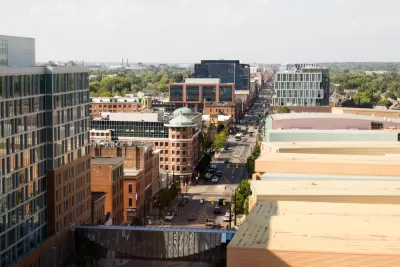
"Columbus, OH introduced a new curbside management pilot program in partnership with mobility company curbFlow in a bid to address demand for deliveries and ride-hailing pick-ups and drop-offs," reports Chris Teale. The program will start next week and last for 12 months at nine locations in downtown Columbus and along a commercial corridor.
"Under the partnership, clearly marked Loading Management Zones (LMZs) will be added for use by commercial vehicles and private vehicles doing commercial work, like being used for ride-hailing. Drivers will use an app to reserve and check in and out of an LMZ," says Teale.
The goal of curbside management is to address issues such as double parking and blocked bike lanes and crosswalks. Other cities have also partnered with businesses to tackle the problem, notes Teale. "In Uber's collaboration with Cincinnati, for instance, it commissioned a curbside study and made a series of recommendations, including freeing up space by removing on-street parking and replacing it with a passenger pick-up and drop-off area, better enforcing loading zones and improving wayfinding and traffic control for motorists."
FULL STORY: Columbus, OH tackles curbside woes with pilot program

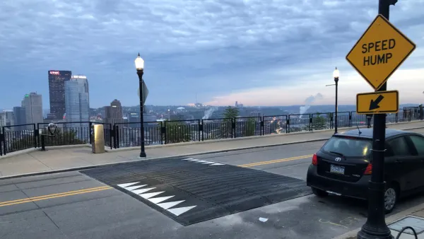
Pittsburgh Excels at Low-Cost, Quick-Build Traffic Calming
The city’s traffic calming initiative has led to a 6 percent average reduction in speeds on corridors with recent interventions.
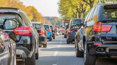
Study: Larger Vehicles Lead to More Congestion
New research links large SUVs to lower traffic throughput.
Milwaukee Announces 60 Traffic Calming Projects for 2025
The city has successfully reduced traffic deaths and aims to eliminate them completely within the next decade.

Planetizen Federal Action Tracker
A weekly monitor of how Trump’s orders and actions are impacting planners and planning in America.

Congressman Proposes Bill to Rename DC Metro “Trump Train”
The Make Autorail Great Again Act would withhold federal funding to the system until the Washington Metropolitan Area Transit Authority (WMATA), rebrands as the Washington Metropolitan Authority for Greater Access (WMAGA).

DARTSpace Platform Streamlines Dallas TOD Application Process
The Dallas transit agency hopes a shorter permitting timeline will boost transit-oriented development around rail stations.

San Francisco's School District Spent $105M To Build Affordable Housing for Teachers — And That's Just the Beginning
SFUSD joins a growing list of school districts using their land holdings to address housing affordability challenges faced by their own employees.

Car-Centric LA Suburb Looks to a Train-Oriented Future
City leaders in Rancho Cucamonga, the future western terminus of the Brightline West rail line to Las Vegas, want to reimagine the city as a transit-oriented, pedestrian-friendly community.

New Alaska Bitcoin Mine Would Burn as Much Energy as the State’s Largest Coal Plant
Fueled by “stranded” natural gas, the startup hopes to become the largest in the US, and to make Alaska an industry center.
Urban Design for Planners 1: Software Tools
This six-course series explores essential urban design concepts using open source software and equips planners with the tools they need to participate fully in the urban design process.
Planning for Universal Design
Learn the tools for implementing Universal Design in planning regulations.
Municipality of Princeton
Roanoke Valley-Alleghany Regional Commission
City of Mt Shasta
City of Camden Redevelopment Agency
City of Astoria
Transportation Research & Education Center (TREC) at Portland State University
US High Speed Rail Association
City of Camden Redevelopment Agency
Municipality of Princeton (NJ)