


In the face of displacement and gentrification, residents of the Fruit Belt neighborhood of Buffalo, NY point to tech-giant Google's map service as one among many possible causes.
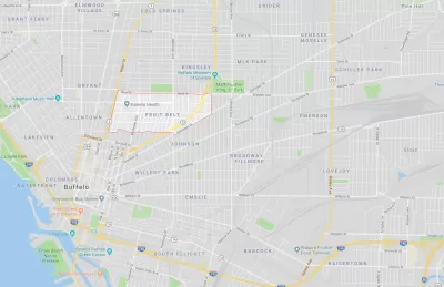
In the late 2000s, public outcry over the development of the Buffalo Niagara Medical Campus in the Fruit Belt neighborhood of Buffalo, NY brought shed light on a complex community identity conflict. Residents saw their drastically changing neighborhood undergo rapid transformation and gentrification. In addition to this displacement, they observed that the name of their neighborhood, the "Fruit Belt," was erased from Google Maps and replaced with the name "Medical Park."
In the historically Black and German immigrant neighborhood, "community members argued the designation was a calculated tweak in favor of gentrification, a digital rechristening," writes Caitlin Dewey. "The misnomer also revealed a great deal about the invisible process major tech firms use to put neighborhoods on their maps—and how decisions based off arcane data sets can affect communities thousands of miles away."
Digital erasure is not the only way the ownership of the Fruit Belt was forcibly removed from long-time residents, notes Dewey:
[D]evelopers tore down low-income townhouses and bought out a nearby African-American cultural center to make way for new apartments and medical offices. Worse, some residents reported rent hikes of as much as 50 percent, and one in three homes sat vacant and unused — a common sign that owners planned to resell them at a higher price.
As a result of Dewey's journalistic research, Good Maps corrected the name of the Fruit Belt. This acknowledgement of collective community autonomy is only a small step in the right direction.
FULL STORY: How Google's Bad Data Wiped a Neighborhood off the Map


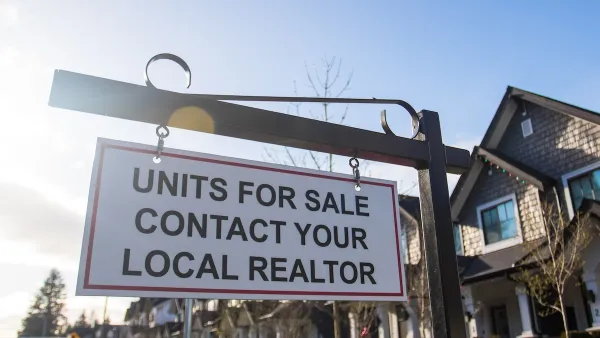
10 U.S. Cities Launch Anti-Displacement Network
More than half of American tenants are rent-burdened, putting them at risk of displacement. A national collaboration with PolicyLink hopes to help.
High Housing Costs Driving Down Transit Ridership in LA
When neighborhoods gentrify and displace lower-income residents, transit ridership suffers, new research shows.
‘Displaced By Design:’ Report Spotlights Gentrification in Black Neighborhoods
A new report finds that roughly 15 percent of U.S. neighborhoods have been impacted by housing cost increases and displacement.

Maui's Vacation Rental Debate Turns Ugly
Verbal attacks, misinformation campaigns and fistfights plague a high-stakes debate to convert thousands of vacation rentals into long-term housing.

Planetizen Federal Action Tracker
A weekly monitor of how Trump’s orders and actions are impacting planners and planning in America.

In Urban Planning, AI Prompting Could be the New Design Thinking
Creativity has long been key to great urban design. What if we see AI as our new creative partner?

King County Supportive Housing Program Offers Hope for Unhoused Residents
The county is taking a ‘Housing First’ approach that prioritizes getting people into housing, then offering wraparound supportive services.

Researchers Use AI to Get Clearer Picture of US Housing
Analysts are using artificial intelligence to supercharge their research by allowing them to comb through data faster. Though these AI tools can be error prone, they save time and housing researchers are optimistic about the future.

Making Shared Micromobility More Inclusive
Cities and shared mobility system operators can do more to include people with disabilities in planning and operations, per a new report.
Urban Design for Planners 1: Software Tools
This six-course series explores essential urban design concepts using open source software and equips planners with the tools they need to participate fully in the urban design process.
Planning for Universal Design
Learn the tools for implementing Universal Design in planning regulations.
planning NEXT
Appalachian Highlands Housing Partners
Mpact (founded as Rail~Volution)
City of Camden Redevelopment Agency
City of Astoria
City of Portland
City of Laramie