


A wealth of pre-authored policy maps lets users access data to explore public policy issues.
The Esri Maps for Public Policy app allows users to quickly and easily put together maps by customizing existing Esri maps. "The app gives users ready-to-use location intelligence and express access to policy maps, so they can skip the steps of obtaining and preparing the data," writes Karisa Schroeder.
The app maps are based on the ArcGIS Living Atlas of the World collection of data, which is constantly updated. Esri Maps for Public Policy users select a location at the local, state, or national level and a topic and then have the option to add data from any of 400 available maps.
"The app includes data on social equity and health, economic opportunity, transportation and infrastructure, resilience and sustainability, the environment and natural resources, and public safety," notes Schroder. Esri is encouraging policymakers and citizens to use the app to help them as they face challenges in their communities around issues such as public health, affordable housing, and mobility.
FULL STORY: Mapping for Community Impact


Esri Sets Up COVID-19 GIS Hub
The planning profession can contribute to the worldwide fight to control the spread of COVID-19. GIS technology, for instance, allows real-time monitoring of the pandemic.

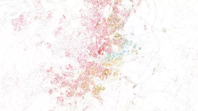
Mapping All the Land Uses in the Lower 48
A massive data visualization project illuminates the land uses that define the United States.

Who's Mapping Gentrification, and Where?
In these cities, data on gentrification has been compiled to build mapping tools documenting the process. The hope is to identify neighborhoods where low-income residents are at risk of displacement.

Planetizen Federal Action Tracker
A weekly monitor of how Trump’s orders and actions are impacting planners and planning in America.

Maui's Vacation Rental Debate Turns Ugly
Verbal attacks, misinformation campaigns and fistfights plague a high-stakes debate to convert thousands of vacation rentals into long-term housing.

San Francisco Suspends Traffic Calming Amidst Record Deaths
Citing “a challenging fiscal landscape,” the city will cease the program on the heels of 42 traffic deaths, including 24 pedestrians.

Defunct Pittsburgh Power Plant to Become Residential Tower
A decommissioned steam heat plant will be redeveloped into almost 100 affordable housing units.

Trump Prompts Restructuring of Transportation Research Board in “Unprecedented Overreach”
The TRB has eliminated more than half of its committees including those focused on climate, equity, and cities.

Amtrak Rolls Out New Orleans to Alabama “Mardi Gras” Train
The new service will operate morning and evening departures between Mobile and New Orleans.
Urban Design for Planners 1: Software Tools
This six-course series explores essential urban design concepts using open source software and equips planners with the tools they need to participate fully in the urban design process.
Planning for Universal Design
Learn the tools for implementing Universal Design in planning regulations.
Heyer Gruel & Associates PA
JM Goldson LLC
Custer County Colorado
City of Camden Redevelopment Agency
City of Astoria
Transportation Research & Education Center (TREC) at Portland State University
Jefferson Parish Government
Camden Redevelopment Agency
City of Claremont