


In these cities, data on gentrification has been compiled to build mapping tools documenting the process. The hope is to identify neighborhoods where low-income residents are at risk of displacement.
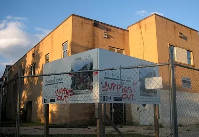
Chris Bousquet writes, "A number of cities have found mapping to be a powerful tool for observing gentrification trends, allowing them to intervene before low-income residents are seriously affected. Cities have created maps using data mostly from public sources both to better understand historical trends in gentrification and displacement and predict the next areas where low-income residents are likely to lose their homes."
Covering the cities of Los Angeles, Portland, Seattle, Boston, San Francisco, and New York, the data visualizations adopt a range of methods to depict both the progress of gentrification and the risk of displacement. For each tool, Bousquet discusses how the developers obtained their data, how they map it, and what additional analysis they undertake, if any.
Bousquet notes that the tools may misinterpret upward economic mobility as displacement. "These tools use mobility data—information on changes in the demographic makeup in neighborhoods—as a proxy for displacement." But as these tools grow more sophisticated, in concert with analyzing general demographic trends, these risk assessments can be made more accurate.
FULL STORY: Where is Gentrification Happening in Your City?


Anticipating Gentrification in Detroit
Where is gentrification most likely to occur in cities like Detroit? And how can that data guide policy? A new report provides some insight.

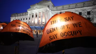
Op-Ed: Time to Ditch the Old Data Used to Separate Gentrification From Displacement
Norman Oder asks readers to question the evidence traditionally cited in arguments that attempt to disprove displacement as a consequence of gentrification.
Visualizing Gentrification in 9 Cities
A new atlas explores the multiple causes of gentrification through bold graphics and data visualizations.

Maui's Vacation Rental Debate Turns Ugly
Verbal attacks, misinformation campaigns and fistfights plague a high-stakes debate to convert thousands of vacation rentals into long-term housing.

Planetizen Federal Action Tracker
A weekly monitor of how Trump’s orders and actions are impacting planners and planning in America.

San Francisco Suspends Traffic Calming Amidst Record Deaths
Citing “a challenging fiscal landscape,” the city will cease the program on the heels of 42 traffic deaths, including 24 pedestrians.

Defunct Pittsburgh Power Plant to Become Residential Tower
A decommissioned steam heat plant will be redeveloped into almost 100 affordable housing units.

Trump Prompts Restructuring of Transportation Research Board in “Unprecedented Overreach”
The TRB has eliminated more than half of its committees including those focused on climate, equity, and cities.

Amtrak Rolls Out New Orleans to Alabama “Mardi Gras” Train
The new service will operate morning and evening departures between Mobile and New Orleans.
Urban Design for Planners 1: Software Tools
This six-course series explores essential urban design concepts using open source software and equips planners with the tools they need to participate fully in the urban design process.
Planning for Universal Design
Learn the tools for implementing Universal Design in planning regulations.
Heyer Gruel & Associates PA
JM Goldson LLC
Custer County Colorado
City of Camden Redevelopment Agency
City of Astoria
Transportation Research & Education Center (TREC) at Portland State University
Jefferson Parish Government
Camden Redevelopment Agency
City of Claremont