


The 4th National Climate Assessment brought the reality of climate change to the regional and local level. The Carolinas provide a particularly poignant case study.
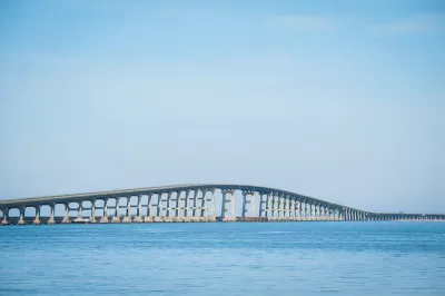
Charles Duncan and Abbie Bennett provide regional details of the effects of climate change for the Carolinas, as predicted by the 4th National Climate Assessment, released by the federal government over the Thanksgiving holiday weekend.
"Climate change will cause more heat waves, flooding and worse storm impacts, and change life for people in the Carolinas," according to the article. "Higher sea levels will bring more and worse coastal flooding, a warming ocean will bring stronger storms, and extreme heat waves will become longer and more frequent in the Southeast," more specifically.
As detailed by the article, the recent history of the Carolinas and the rest of the Southeast is one of a changing climate, with recording flooding caused by hurricanes Matthew and Florence, records for costs incurred by weather events, and record tides just last week in Charleston.
The article stops short, however, of connecting the dots between the predictions of the report and any of the policies in place in southeastern states to mitigate the causes or the effects of climate change.North Carolina in particular has provided a compelling example of a state adjusting its approach to climate change in recent years, with mixed results from an environmental perspective in a period of rapid growth.
For more regional assessment of the predictions included in the 4th National Climate Assessment, see an article by Grist also shared on Planetizen recently.
FULL STORY: White House: 1,500% jump in coastal flooding, unprecedented heat waves for Carolinas

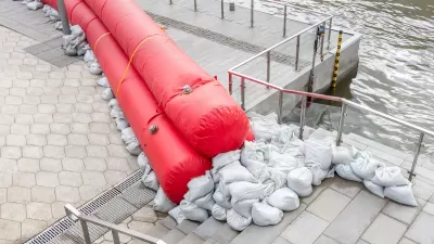
Planning for Future Floods
New climate and flood models are needed to understand growing flood risks.
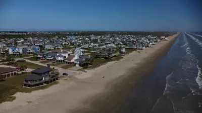
Looking for a Beach House? Check Your Risk First.
A new report from the insurance industry names the historic town of Galveston, Texas as the riskiest place to buy a beach house in the United States.
Flooding in the Midwest Shows There's No Refuge From Climate Change
While projections say areas of the U.S. Midwest around the Great Lakes will become more hospitable as the climate changes, stormwater and flooding is still a challenge in a surprising number of locations.

Planetizen Federal Action Tracker
A weekly monitor of how Trump’s orders and actions are impacting planners and planning in America.

San Francisco's School District Spent $105M To Build Affordable Housing for Teachers — And That's Just the Beginning
SFUSD joins a growing list of school districts using their land holdings to address housing affordability challenges faced by their own employees.

The Tiny, Adorable $7,000 Car Turning Japan Onto EVs
The single seat Mibot charges from a regular plug as quickly as an iPad, and is about half the price of an average EV.

Engineers Gave America's Roads an Almost Failing Grade — Why Aren't We Fixing Them?
With over a trillion dollars spent on roads that are still falling apart, advocates propose a new “fix it first” philosophy.

The European Cities That Love E-Scooters — And Those That Don’t
Where they're working, where they're banned, and where they're just as annoying the tourists that use them.

Map: Where Senate Republicans Want to Sell Your Public Lands
For public land advocates, the Senate Republicans’ proposal to sell millions of acres of public land in the West is “the biggest fight of their careers.”
Urban Design for Planners 1: Software Tools
This six-course series explores essential urban design concepts using open source software and equips planners with the tools they need to participate fully in the urban design process.
Planning for Universal Design
Learn the tools for implementing Universal Design in planning regulations.
Borough of Carlisle
Smith Gee Studio
City of Camden Redevelopment Agency
City of Astoria
Transportation Research & Education Center (TREC) at Portland State University
City of Camden Redevelopment Agency
Municipality of Princeton (NJ)