


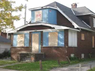
Cleveland neighborhoods were coded to help real estate investors, but the result is a map that harks back to old discriminatory housing practices, say critics.
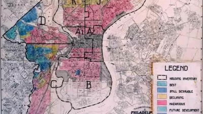
Brentin Mock reports on recent controversy over a 2015 blog post about a map of Cleveland that looks much like redlining maps from the last century. The map, produced by a local real estate developer, graded the city’s neighborhoods, ostensibly to provide investors with a guide to where they might get the best return on investments.
But, says Mock, the grades highlight race and class segregation throughout the city:
The red “F” category is called the “Warzone” in [James] Wise’s blog, and consists of the African-American East Cleveland neighborhood and several zip codes that have majority black populations, and most of which have incomes below $22,000. The D category, also red, consists of just three neighborhoods, each of which have sizable black and Latino populations, all located in the city and with majority renter populations.
The Home Owners Loan Corporation redlining maps of the 1930s divided the city based on similar metrics, and designations of “neighborhood desirability” drove investment and home loan decisions. “Desirability was defined by the neighborhood’s household incomes, the percentage of homeowners, and by 'homogeneity'—whether white people made up the majority of the neighborhood,” reports Mock.
Some housing advocates wonder if the more recent map could actually help residents in lower-income neighborhoods over the long run. Investors looking to flip properties and make a quick buck might be motivated to steer clear of Cleveland’s most vulnerable neighborhoods, says Mock.
FULL STORY: The Brazen Redlining Happening in Cleveland


Rethinking Redlining
For decades we have blamed 100-year-old maps for the patterns of spatial racial inequity that persist in American cities today. An esteemed researcher says: we’ve got it all wrong.
New Research Reexamines HOLC's Role in Redlining
New Deal agencies did engage in discriminatory lending practices–but not quite in the way we think.
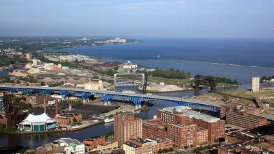
Cleveland Has Yet to Recover From the Last Recession
Decades of racist policy and a lack of critical resources have left Cleveland in a perpetual state of economic fragility. The city can't afford another recession.

Planetizen Federal Action Tracker
A weekly monitor of how Trump’s orders and actions are impacting planners and planning in America.

San Francisco's School District Spent $105M To Build Affordable Housing for Teachers — And That's Just the Beginning
SFUSD joins a growing list of school districts using their land holdings to address housing affordability challenges faced by their own employees.

The Tiny, Adorable $7,000 Car Turning Japan Onto EVs
The single seat Mibot charges from a regular plug as quickly as an iPad, and is about half the price of an average EV.

Seattle's Plan for Adopting Driverless Cars
Equity, safety, accessibility and affordability are front of mind as the city prepares for robotaxis and other autonomous vehicles.

As Trump Phases Out FEMA, Is It Time to Flee the Floodplains?
With less federal funding available for disaster relief efforts, the need to relocate at-risk communities is more urgent than ever.

With Protected Lanes, 460% More People Commute by Bike
For those needing more ammo, more data proving what we already knew is here.
Urban Design for Planners 1: Software Tools
This six-course series explores essential urban design concepts using open source software and equips planners with the tools they need to participate fully in the urban design process.
Planning for Universal Design
Learn the tools for implementing Universal Design in planning regulations.
Smith Gee Studio
City of Charlotte
City of Camden Redevelopment Agency
City of Astoria
Transportation Research & Education Center (TREC) at Portland State University
US High Speed Rail Association
City of Camden Redevelopment Agency
Municipality of Princeton (NJ)