


A closer look at the numbers reveals stark divides among Toronto neighborhoods.
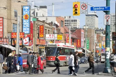
A new study of Canadian census data shows significant racial and income segregation throughout Toronto. The lowest-income neighborhoods, with average incomes less than $32,000, make up almost half of the city's census tracts, and 68 percent of residents in these neighborhoods are non-white. On the other hand, 23 percent of Toronto's census tracts include neighborhoods with average incomes of $102,000, and two-thirds of these residents are white.
These findings indicate that financial resources give people access to particular neighborhoods. But other issues might also be in play, writes Sandro Contenta:
Choice also partly explains the makeup of low-income neighbourhoods. Some members of ethnic groups prefer to live where their communities are most numerous, giving them easy access to the shops and cultural or religious services that facilitate integration or simply make life more enjoyable.
However, the study also found that half of residents in these neighborhoods have post-secondary degrees, and they say this relatively high percentage of educated residents with low incomes suggests discrimination is playing a role in the disparities. In addition, 57 percent of low-income neighborhoods are made up of immigrants as compared to 31 percent of high-income neighborhoods.
Researchers have pointed to institutional factors that have contributed to the demographic landscape of Toronto:
The polarized income trend dates back to the 1990s, caused by federal and provincial cuts in transfer payments and social assistance, along with tax cuts, rising housing costs and the disappearance of well-paid manufacturing jobs, [researcher David] Hulchanski says.
They argue that government policies are needed to reverse these segregation trends and avoid the sort of social and political conflict seen in European countries.
FULL STORY: Toronto is segregated by race and income. And the numbers are ugly

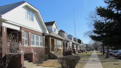
Mapped: Chicago's Shrinking Middle Class
In 1970, half of the city's census tracts were middle-income. Now, only 16 percent of them remain so. Polarization between the well-off and the poor essentially splits the city in two.
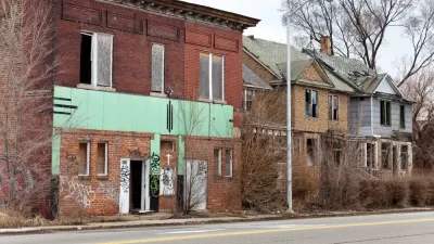
Why Canadian Cities Avoided Detroit's Fate
Simply put, this scholar says, it comes down to race. With far fewer non-white urban residents, Canadian cities didn't fall prey to the redlining, white flight, and incarceration problems that so heavily impacted cities like Detroit.
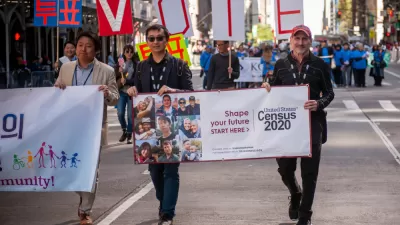
News Brief: Census 2020 Population Data
Most of the media commentary that followed last week's release of Census 2020 data focused on trends in the racial demographics of the country and the country's growing rural-urban divide.

Planetizen Federal Action Tracker
A weekly monitor of how Trump’s orders and actions are impacting planners and planning in America.

Restaurant Patios Were a Pandemic Win — Why Were They so Hard to Keep?
Social distancing requirements and changes in travel patterns prompted cities to pilot new uses for street and sidewalk space. Then it got complicated.

Map: Where Senate Republicans Want to Sell Your Public Lands
For public land advocates, the Senate Republicans’ proposal to sell millions of acres of public land in the West is “the biggest fight of their careers.”

Maui's Vacation Rental Debate Turns Ugly
Verbal attacks, misinformation campaigns and fistfights plague a high-stakes debate to convert thousands of vacation rentals into long-term housing.

San Francisco Suspends Traffic Calming Amidst Record Deaths
Citing “a challenging fiscal landscape,” the city will cease the program on the heels of 42 traffic deaths, including 24 pedestrians.

California Homeless Arrests, Citations Spike After Ruling
An investigation reveals that anti-homeless actions increased up to 500% after Grants Pass v. Johnson — even in cities claiming no policy change.
Urban Design for Planners 1: Software Tools
This six-course series explores essential urban design concepts using open source software and equips planners with the tools they need to participate fully in the urban design process.
Planning for Universal Design
Learn the tools for implementing Universal Design in planning regulations.
Heyer Gruel & Associates PA
JM Goldson LLC
Custer County Colorado
City of Camden Redevelopment Agency
City of Astoria
Transportation Research & Education Center (TREC) at Portland State University
Camden Redevelopment Agency
City of Claremont
Municipality of Princeton (NJ)