


The draft plan targets improvements on 385 road segments.

The San Francisco Municipal Transportation Agency (SFMTA) board is set to review the city’s draft Biking and Rolling plan, which sets the goal of putting a “safe bike route” within a quarter mile of every resident’s home.
As Rachel Swan explains in the San Francisco Chronicle, “The current draft lists 385 routes or street segments that are targeted for upgrades, ranging from brighter striping on crosswalks, to barriers along bike lanes.” The city wants to encourage residents to use bikes for short, local trips by making neighborhood roads safer for kids and older riders, particularly near schools.
The plan calls for more interconnected bikeways, speed bumps, and other measures to improve safety and link existing bike lanes, as well as reducing conflicts between pedestrians and scooters. But it could face backlash from residents concerned about the loss of parking and driving lanes.
Swan adds, “Roads are a utility. But they also reflect a city’s values. For decades, San Franciscans have battled over how streets should function and which transportation modes should get priority. In recent years, SFMTA has reclaimed space from cars and dedicated it for bikes, scooters, or pedestrians, instituting a ‘quick-build’ process to streamline these projects.”
FULL STORY: S.F. to unveil its most ambitious bicycle plan in years, targeting hundreds of routes for upgrades

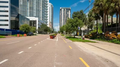
St. Petersburg’s Bike Infrastructure Efforts Pay Off
New bike infrastructure is encouraging more people to take to the streets on two wheels, but advocates say safety challenges remain.

Bike Resolutions for the New Year
A list of ways people can enhance their biking experience, appreciate the joy of cycling, and support safer bike infrastructure.

The Rippling Effects of Bike-to-Work Subsidies
A European movement to incentivize people to commute by bicycle is changing travel patterns and making mobility more sustainable.

Maui's Vacation Rental Debate Turns Ugly
Verbal attacks, misinformation campaigns and fistfights plague a high-stakes debate to convert thousands of vacation rentals into long-term housing.

Planetizen Federal Action Tracker
A weekly monitor of how Trump’s orders and actions are impacting planners and planning in America.

In Urban Planning, AI Prompting Could be the New Design Thinking
Creativity has long been key to great urban design. What if we see AI as our new creative partner?

King County Supportive Housing Program Offers Hope for Unhoused Residents
The county is taking a ‘Housing First’ approach that prioritizes getting people into housing, then offering wraparound supportive services.

Researchers Use AI to Get Clearer Picture of US Housing
Analysts are using artificial intelligence to supercharge their research by allowing them to comb through data faster. Though these AI tools can be error prone, they save time and housing researchers are optimistic about the future.

Making Shared Micromobility More Inclusive
Cities and shared mobility system operators can do more to include people with disabilities in planning and operations, per a new report.
Urban Design for Planners 1: Software Tools
This six-course series explores essential urban design concepts using open source software and equips planners with the tools they need to participate fully in the urban design process.
Planning for Universal Design
Learn the tools for implementing Universal Design in planning regulations.
planning NEXT
Appalachian Highlands Housing Partners
Mpact (founded as Rail~Volution)
City of Camden Redevelopment Agency
City of Astoria
City of Portland
City of Laramie