


Building housing near transportation networks can improve density and walkability, but can also have serious health consequences for residents.
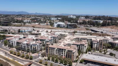
In a piece for Next City, Michael Austin warns that many types of transit-oriented development — which places housing and services near transportation corridors — can have detrimental public health effects when not planned with public health outcomes in mind.
Austin points out that living in close proximity to freeways and major arterial streets is a well-documented health hazard. “Comprehensive articles and academic studies highlight the harmful impacts of living near major roadways, yet development in these areas continues despite known risks.” Even the imminent electrification of the transportation sector, were it to accelerate, wouldn’t completely eliminate emissions, and wouldn’t solve attendant problems such as noise and other sensory impacts.
According to Austin, “When developing TODs along active corridors, it’s important to prioritize housing that’s set no closer than 500 feet — and ideally, 1,000 feet — from major arterials and freeways, as suggested by UCLA researchers and the California Air Resources Board.” He also suggests concentrating commercial, retail, office, and civic uses closer to transit stations.
Austin offers several recommendations for building TOD that takes into account public health: expanding the TOD boundary to include areas farther from major roads; reinforcing health planning through design guidelines; and avoiding housing in active industrial areas.
FULL STORY: Transit-Oriented Housing Development Is Great For Density and Walkability. What About Air Quality?

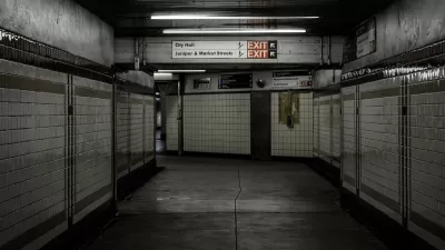
How Does Air Quality in a Philly Subway Station Compare to the Outdoors?
A team of researchers found much higher levels of particulate matter inside the City Hall subway station than on the street-level sidewalks directly above the station.
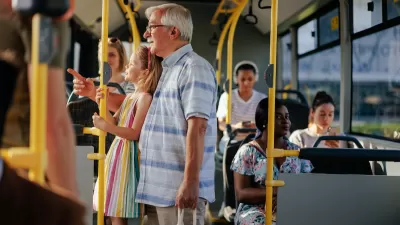
Opinion: To Improve Health Outcomes, Invest in Public Transit
A medical student calls for improving public transit to boost the health of people and the environment.
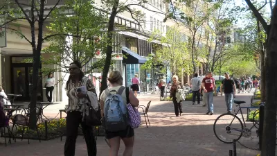
The Relationship Between Walkability and Public Health
New research indicates that improving public health requires targeted investments in more than just pedestrian facilities.

Planetizen Federal Action Tracker
A weekly monitor of how Trump’s orders and actions are impacting planners and planning in America.

Restaurant Patios Were a Pandemic Win — Why Were They so Hard to Keep?
Social distancing requirements and changes in travel patterns prompted cities to pilot new uses for street and sidewalk space. Then it got complicated.

Map: Where Senate Republicans Want to Sell Your Public Lands
For public land advocates, the Senate Republicans’ proposal to sell millions of acres of public land in the West is “the biggest fight of their careers.”

Maui's Vacation Rental Debate Turns Ugly
Verbal attacks, misinformation campaigns and fistfights plague a high-stakes debate to convert thousands of vacation rentals into long-term housing.

San Francisco Suspends Traffic Calming Amidst Record Deaths
Citing “a challenging fiscal landscape,” the city will cease the program on the heels of 42 traffic deaths, including 24 pedestrians.

California Homeless Arrests, Citations Spike After Ruling
An investigation reveals that anti-homeless actions increased up to 500% after Grants Pass v. Johnson — even in cities claiming no policy change.
Urban Design for Planners 1: Software Tools
This six-course series explores essential urban design concepts using open source software and equips planners with the tools they need to participate fully in the urban design process.
Planning for Universal Design
Learn the tools for implementing Universal Design in planning regulations.
Heyer Gruel & Associates PA
JM Goldson LLC
Custer County Colorado
City of Camden Redevelopment Agency
City of Astoria
Transportation Research & Education Center (TREC) at Portland State University
Camden Redevelopment Agency
City of Claremont
Municipality of Princeton (NJ)