


The study will assess alignment options for a 13-mile segment of the greenway.
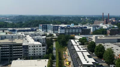
Atlanta BeltLine Inc. has launched a two-year study to assess the potential for transit options and station locations that would serve over 13 miles of the 22-mile urban trail, reports Josh Green in Urbanize Atlanta. The study will be conducted by engineering firm Kimley-Horn & Associates. According to BeltLine president and CEO Clyde Higgs, transit is a keypart of the project’s mission. “The BeltLine is about high-quality ways to connect people to jobs, healthcare, shopping, education, and opportunity while making Atlanta a more mobile city”
Green adds, “The goal of the study is to determine the preferred alignment for BeltLine transit—and to pinpoint the best locations for stations—in a section near the BeltLine called the northwest quadrant, stretching from the Westside near MARTA's Bankhead station up to southern Buckhead.”
The study is tasked with focusing specifically on connecting the growing regional trails network and transit system and making the BeltLine more accessible to more residents. “Kimley-Horn’s work is expected to cover field investigation for new transit, consolidation of previous studies, ridership forecasting, financial planning, environmental screening, stakeholder and public outreach, and equity considerations, among other aspects.”
FULL STORY: BeltLine launches study for nearly 14 miles of transit around loop

As Projected Beltline Costs Rise, Atlanta Considers Other Options
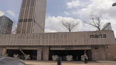
MARTA's light rail project could cost more than twice original estimates, prompting the agency to weigh different routes and the potential for bus rapid transit as an alternative to rail.

Atlanta Changes Beltline Rail Plan
City officials say they are committed to building rail connections, but are nixing a prior plan to extend the streetcar network.
Atlanta Announces Four New MARTA Stations
The city’s Beltline will gain a new connection to heavy rail.

Planetizen Federal Action Tracker
A weekly monitor of how Trump’s orders and actions are impacting planners and planning in America.

Congressman Proposes Bill to Rename DC Metro “Trump Train”
The Make Autorail Great Again Act would withhold federal funding to the system until the Washington Metropolitan Area Transit Authority (WMATA), rebrands as the Washington Metropolitan Authority for Greater Access (WMAGA).

The Simple Legislative Tool Transforming Vacant Downtowns
In California, Michigan and Georgia, an easy win is bringing dollars — and delight — back to city centers.

The States Losing Rural Delivery Rooms at an Alarming Pace
In some states, as few as 9% of rural hospitals still deliver babies. As a result, rising pre-term births, no adequate pre-term care and harrowing close calls are a growing reality.

The Small South Asian Republic Going all in on EVs
Thanks to one simple policy change less than five years ago, 65% of new cars in this Himalayan country are now electric.

DC Backpedals on Bike Lane Protection, Swaps Barriers for Paint
Citing aesthetic concerns, the city is removing the concrete barriers and flexposts that once separated Arizona Avenue cyclists from motor vehicles.
Urban Design for Planners 1: Software Tools
This six-course series explores essential urban design concepts using open source software and equips planners with the tools they need to participate fully in the urban design process.
Planning for Universal Design
Learn the tools for implementing Universal Design in planning regulations.
Smith Gee Studio
City of Charlotte
City of Camden Redevelopment Agency
City of Astoria
Transportation Research & Education Center (TREC) at Portland State University
US High Speed Rail Association
City of Camden Redevelopment Agency
Municipality of Princeton (NJ)