


Norwalk, Connecticut is figuring out how to balance the competing interests of development demand, public access, environmental risks, and historic preservation.
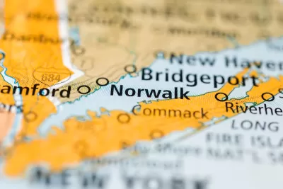
Norwalk, located in Fairfield County, Connecticut, is working on a new waterfront plan that balances the community’s long history and the contemporary risks of sea-level rise and climate change.
According to an article by Katherine Lutge, the city has been planning the future of the waterfront since 2021. Boston-based firm UTILE Architecture & Planning produced the "Norwalk Industrial Waterfront Land Use Study" earlier this year, and now several local organizations are concerned about zoning and other changes proposed by the report.
According to the city, the three primary goals of the plan are to increase public access to the waterfront, retain commercial and industrial water dependent uses, and address environmental concerns through development best practices.
“By proposing zoning that allows for mixed-use development that is water dependent, there is an opportunity to redevelop the sites closest to Washington Street, which may activate the waterfront area for public access. This could potentially include restaurants, boardwalks, boat slips and public open space,” according to a statement from the city quoted in the article.
Lutge also reports, however, that the Harbor Management Commission, Shellfish Commission, and Water Quality Commission are raising concerns about the possibility of new development density on the city’s waterfront, potentially in the 100-year floodplain.
More details about the proposed zoning changes, and the emerging opposition to those changes, are included in the source article below.
FULL STORY: Norwalk debates history, density and future of waterfront due to new plan, zoning rewrite

Maryland Awards $1.25M in TOD-Related Grants
The state’s DOT is funding projects that prepare sites around transit stations for future mixed-use development and housing.

NYC Zoning Reform: Where Will It Have an Impact?
The zoning reform package dubbed ‘City of Yes’ will likely yield uneven results, with many of the lowest-density neighborhoods exempted from new regulations.

‘Grand Boulevards’ Could Ease Housing Crisis
A prominent urbanist argues that redeveloping commercial corridors with denser housing could bridge the gap between the housing supply and demand.

Planetizen Federal Action Tracker
A weekly monitor of how Trump’s orders and actions are impacting planners and planning in America.

Restaurant Patios Were a Pandemic Win — Why Were They so Hard to Keep?
Social distancing requirements and changes in travel patterns prompted cities to pilot new uses for street and sidewalk space. Then it got complicated.

Map: Where Senate Republicans Want to Sell Your Public Lands
For public land advocates, the Senate Republicans’ proposal to sell millions of acres of public land in the West is “the biggest fight of their careers.”

Maui's Vacation Rental Debate Turns Ugly
Verbal attacks, misinformation campaigns and fistfights plague a high-stakes debate to convert thousands of vacation rentals into long-term housing.

San Francisco Suspends Traffic Calming Amidst Record Deaths
Citing “a challenging fiscal landscape,” the city will cease the program on the heels of 42 traffic deaths, including 24 pedestrians.

California Homeless Arrests, Citations Spike After Ruling
An investigation reveals that anti-homeless actions increased up to 500% after Grants Pass v. Johnson — even in cities claiming no policy change.
Urban Design for Planners 1: Software Tools
This six-course series explores essential urban design concepts using open source software and equips planners with the tools they need to participate fully in the urban design process.
Planning for Universal Design
Learn the tools for implementing Universal Design in planning regulations.
Heyer Gruel & Associates PA
JM Goldson LLC
Custer County Colorado
City of Camden Redevelopment Agency
City of Astoria
Transportation Research & Education Center (TREC) at Portland State University
Camden Redevelopment Agency
City of Claremont
Municipality of Princeton (NJ)