The southeast Texas city is responding to community demands for safer, more accessible, and more diverse transportation choices.



Sugar Land, Texas,is adopting a new Mobility Master Plan aimed at aligning the goals and proposals in prior mobility, roadway, and bike and pedestrian plans and improving mobility for all types of road users in the sprawling, heavily car-oriented city southwest of Houston.
An article in the Fort Bend Independent quotes the master plan, which states:
For decades Sugar Land has successfully invested in mobility, primarily by building new streets and trails and increasing vehicular capacity.
To complement these investments, the community has asked the City to expand safe, healthy, and active transportation choices for all users, and continue to deploy mobility technology and update design treatments to optimize the space on existing streets.
The plan highlights the interconnectedness of transportation and land use policies, noting that “City staff should integrate public health considerations into all facets of transportation decision-making. This includes expanding greenspace for healthy activities, improving air quality, and ensuring that everyone can access their day-to-day destinations without a car.”
According to the plan, “the City must strategically re-imagine existing street corridors, build on innovative Intelligent Transportation System (ITS) investments, and adapt existing programs and policies to meet the evolving needs of the community.”
The plan establishes six ‘mobility metrics’ and a framework for tracking progress. “This plan identifies focus corridors for investment in a connected Transformative Mobility Network (TMN). Alongside this network, targeted Strategies & Action Items detail the projects, programs, and policies for the City to pursue over the next decade.”
The plan adds, “This Strategy supports further investment in the existing demand response and park & ride services within Fort Bend County while also exploring other options, including microtransit, that support connectivity and access for Sugar Land residents, businesses, and commuters.” As part of the city’s goal to provide more transportation options, in May, the city applied for a grant from the Houston-Galveston Area Council (H-GAC) to establish an on-demand microtransit pilot program.
Read the full story: Sugar Land Reimagines The City’s Future With A New Mobility Master Plan

Is Microtransit a Threat to ‘Real Transit’?
A new report warns that microtransit is nothing more than a taxpayer funded Uber with potentially dangerous consequences for existing traditional transit services.
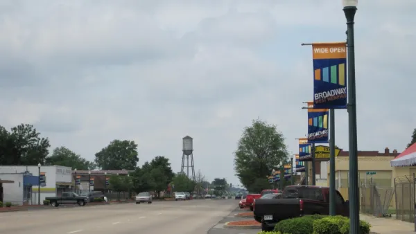
West Memphis to launch new transit system
The city across the Mississippi River from Memphis, Tennessee will soon begin service on its own, on-demand transit system.

El Paso launches improved bus network, new microtransit service
Sun Metro is eliminating some bus lines in favor of more frequent service, estimating that only 1% of riders will have to walk farther to reach a station.

Planetizen Federal Action Tracker
A weekly monitor of how Trump’s orders and actions are impacting planners and planning in America.

Eastern Nebraska is running out of electricity
Data centers and electrification are straining eastern Nebraska’s grid, throttling economic development.

Study reveals best places in the U.S. for cycling, walking
New research from Streetlight Data examines bicycle and pedestrian miles per capita in the 100 largest U.S. cities by population.

DSA members accuse Mamdani of 'abandoning values' over housing redevelopment
New York City's mayor plans to replace about 2,000 units of public housing with private, mixed-income housing.

All sides of BRT debate unhappy with CDOT’s most recent move
The Colorado Department of Transportation is no longer considering center-running bus lanes for Colorado Boulevard.

Massachusetts bogs generate both power, and cranberries
Putting solar panels above farmland is one way Massachusetts is advancing toward its goal of net-zero carbon emissions by 2050.

FREE Course: Walkable City 1: Why Walkability?
After describing his path towards focusing on walkability as the essence of good planning, Jeff Speck marches through his five principal reasons for making more walkable places.
Reinventing Malls: Planning Alchemy—Turning Gray Fields Into Gold
The course focuses on the opportunities and imperatives that shape reinvention of mall sites.

City of Rosemead
Rutgers University, Edward J. Bloustein School of Planning and Public Policy
One Hundred Miles
University of Michigan School for Environment and Sustainability (SEAS)
Hunter College, City University of New York (CUNY)
The Architects Foundation
City of Cambridge
The Pocatello Development Authority
The Urban Renewal Agency of the City of Pocatello