


A plan backed by New York City Mayor Eric Adams would repurpose 25 percent of the city’s street space for multimodal transportation and pedestrian plazas.
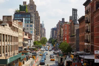
As reported by Micah Toll, a new plan from Transportation Alternatives known as NYC 25×25 would reclaim “the equivalent of 13 Central Parks worth of public space” from cars. “The proposal calls for 25% of NYC’s street space to be converted into walkable pedestrian plazas, bike lanes, green space, and bus lanes by 2025.”
According to the article, “With traffic-clogged streets moving at an average of 5 mph (8 km/h) in Midtown Manhattan, private automobile transportation in NYC is responsible for a significant portion of the city’s carbon emissions, air pollution, and urban grime.” And despite the fact that the majority of New Yorkers don’t own a car, “NYC currently has around 3 million free parking spots lining its streets, which is more than the number of cars registered in the city.” As Toll writes, “Repurposing street space would help to both clean the city and better serve its residents.”
The article notes that “Transportation Alternatives’ plan for NYC would see the creation of 500 miles (800 km) of dedicated bus lanes, another 500 miles of protected bike lanes, new secure garbage containers to prevent the piling of garbage mounds on sidewalks, and widespread community use of car-free roads.”
FULL STORY: NYC wants to take 25% of its street space away from cars in favor of a walkable/bikeable city

NYC Streets Plan Remains Largely on Paper
For the second year in a row, the city failed to meet legally required targets for building protected bike lanes and bus lanes.
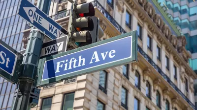
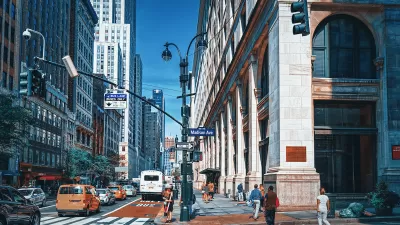
What Will Become of Fifth Avenue?
Visitors to the iconic shopping street overwhelmingly arrive by walking, transit, or bike. Why are bike and pedestrian infrastructure improvement lagging so far behind another famous NYC street, Broadway?
New York City Council Pushing for Major Investments in Bus and Bike Lanes
The $3.1 billion requested by the New York City Council to build 500 miles of new bus lanes and 500 miles of protected bus lanes isn't included in New York Mayor Eric Adams's proposed budget.

Maui's Vacation Rental Debate Turns Ugly
Verbal attacks, misinformation campaigns and fistfights plague a high-stakes debate to convert thousands of vacation rentals into long-term housing.

Planetizen Federal Action Tracker
A weekly monitor of how Trump’s orders and actions are impacting planners and planning in America.

San Francisco Suspends Traffic Calming Amidst Record Deaths
Citing “a challenging fiscal landscape,” the city will cease the program on the heels of 42 traffic deaths, including 24 pedestrians.

Half of Post-Fire Altadena Home Sales Were to Corporations
Large investors are quietly buying up dozens of properties in Altadena, California, where a devastating wildfire destroyed more than 6,000 homes in January.

Opinion: What San Francisco’s Proposed ‘Family Zoning’ Could Really Mean
Mayor Lurie is using ‘family zoning’ to encourage denser development and upzoning — but could the concept actually foster community and more human-scale public spaces?

Jacksonville Launches First Autonomous Transit Shuttle in US
A fleet of 14 fully autonomous vehicles will serve a 3.5-mile downtown Jacksonville route with 12 stops.
Urban Design for Planners 1: Software Tools
This six-course series explores essential urban design concepts using open source software and equips planners with the tools they need to participate fully in the urban design process.
Planning for Universal Design
Learn the tools for implementing Universal Design in planning regulations.
Gallatin County Department of Planning & Community Development
Heyer Gruel & Associates PA
JM Goldson LLC
City of Camden Redevelopment Agency
City of Astoria
Transportation Research & Education Center (TREC) at Portland State University
Jefferson Parish Government
Camden Redevelopment Agency
City of Claremont