


The former program manager for Smart Columbus discusses the successes, challenges, and unexpected opportunities encountered by the city as it worked to integrate technology into city services and programs.
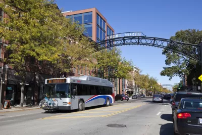
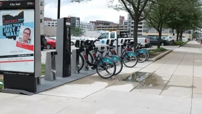
When Columbus won up to $50 million in grant funds through the Department of Transportation's Smart City Challenge program in 2016, the city "implemented a sophisticated operating system that handled complex data analytics; connected vehicle technology; a prenatal trip assistance program; kiosks that help residents plan trips; autonomous shuttles; a trip-planning app called Pivot; and a parking payment app." With the program having just concluded, Danielle McLean relates Smart Cities Dive's interview with Mandy K. Bishop, Columbus’ deputy director of public service and former Smart Columbus program manager. Bishop reflects on the challenges and opportunities presented by the program and how the city plans to continue the most successful parts of the program.
Bishop recounts the efforts the city made to "reach communities through multiple different media, including digital" but also more time-consuming outreach methods like door hangers and printed informational materials. During its implementation, the program "reduced greenhouse gas emissions estimated by about two and three-quarters percent," developed a public transit and mobile parking app, and created a broadband pilot program.
When looking to implement 'smart city' solutions, she recommends engaging with residents throughout the process, which "develops a level of trust" and provides a continual input of information from the community. In this way, Bishop says, "[y]ou end up with a product that actually solves the user challenge at the end."
Bishop says the initiative also identified new needs and opportunities for the future. "[Y]ou’re going to continue to see a leveraging of the engagement platforms that we built, we’re going to continue to see availability of the new mobility applications as well as infrastructure that we built including our connected vehicle environment. You’re going to continue seeing the city iterate and challenge itself to be bold."
FULL STORY: 6 questions with Smart Columbus on lessons since program's conclusion


Five Years Later, 'Smart Cities Challenge' Promise Unfulfilled
The "Smart Cities Challenge" paid Columbus, Ohio $50 million to kick start a revolution of urban technology. The revolution never arrived, according to a recent assessment by Wired writer Aarian Marshall.

'Smart Columbus Operation System' Looking for Developers
"Smart City" plans for the city of Columbus are taking shape.
Columbus Just Changed its 'Smart City' Plan
The original plan earned the city a highly competitive $40 million grant from the U.S. Department of Transportation.

Planetizen Federal Action Tracker
A weekly monitor of how Trump’s orders and actions are impacting planners and planning in America.

Restaurant Patios Were a Pandemic Win — Why Were They so Hard to Keep?
Social distancing requirements and changes in travel patterns prompted cities to pilot new uses for street and sidewalk space. Then it got complicated.

Map: Where Senate Republicans Want to Sell Your Public Lands
For public land advocates, the Senate Republicans’ proposal to sell millions of acres of public land in the West is “the biggest fight of their careers.”

Orange County, Florida Adopts Largest US “Sprawl Repair” Code
The ‘Orange Code’ seeks to rectify decades of sprawl-inducing, car-oriented development.

Maui's Vacation Rental Debate Turns Ugly
Verbal attacks, misinformation campaigns and fistfights plague a high-stakes debate to convert thousands of vacation rentals into long-term housing.

San Francisco Suspends Traffic Calming Amidst Record Deaths
Citing “a challenging fiscal landscape,” the city will cease the program on the heels of 42 traffic deaths, including 24 pedestrians.
Urban Design for Planners 1: Software Tools
This six-course series explores essential urban design concepts using open source software and equips planners with the tools they need to participate fully in the urban design process.
Planning for Universal Design
Learn the tools for implementing Universal Design in planning regulations.
Heyer Gruel & Associates PA
JM Goldson LLC
Custer County Colorado
City of Camden Redevelopment Agency
City of Astoria
Transportation Research & Education Center (TREC) at Portland State University
Camden Redevelopment Agency
City of Claremont
Municipality of Princeton (NJ)