


Transit advocates say that outdated road widening plans contradict the city's Climate Action Plan.

Despite the city's stated commitment "to cut back on car dependence by making streets safer and more oriented towards pedestrians, cyclists, and public transit" San Diego continues to widen roads based on outdated plans, reports Andrew Bowen.
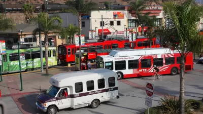
One of the city's deadliest streets, El Cajon Boulevard, is slated to receive a new right-turn lane that would also shrink the footprint of the adjacent Fair@44 pedestrian plaza. Meanwhile, the permit for a trolley extension on Morena Boulevard required the re-widening of the street, creating dangerous conditions for pedestrians trying to reach the trolley station. Pedestrian and transit advocates say these and similar projects go against the city's 2015 Climate Action Plan, "which legally binds the city to cut back on driving by prioritizing less polluting modes of transportation."
"A lot of cities, including San Diego, haven't caught up to the value statements that their elected officials have signed onto," says Colin Parent, executive director of the nonprofit think tank Circulate San Diego. "Parent added that the city had to find a balance between redoing its old plans while not letting that work delay important projects like the trolley extension through Bay Park or the affordable housing project on El Cajon Boulevard."
FULL STORY: San Diego Pledged To Shift Away From Cars. So Why Is It Still Widening Roads?

Report: San Diego Transportation Plan Won't Meet Climate Goals
A regional plan announced by the San Diego Association of Governments will fall short of the city's goals to increase alternate mode trips to 50 percent, report finds.

San Diego Region Developing Long-Range Transportation Plan
The new plan, set to take effect in 2025, accounts for changes in mobility patterns brought on by remote work.
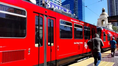
San Diego Trolley Nation’s Most Popular Light Rail
The system's ridership benefited from an extension project and free transit for youth.

Maui's Vacation Rental Debate Turns Ugly
Verbal attacks, misinformation campaigns and fistfights plague a high-stakes debate to convert thousands of vacation rentals into long-term housing.

Planetizen Federal Action Tracker
A weekly monitor of how Trump’s orders and actions are impacting planners and planning in America.

In Urban Planning, AI Prompting Could be the New Design Thinking
Creativity has long been key to great urban design. What if we see AI as our new creative partner?

King County Supportive Housing Program Offers Hope for Unhoused Residents
The county is taking a ‘Housing First’ approach that prioritizes getting people into housing, then offering wraparound supportive services.

Researchers Use AI to Get Clearer Picture of US Housing
Analysts are using artificial intelligence to supercharge their research by allowing them to comb through data faster. Though these AI tools can be error prone, they save time and housing researchers are optimistic about the future.

Making Shared Micromobility More Inclusive
Cities and shared mobility system operators can do more to include people with disabilities in planning and operations, per a new report.
Urban Design for Planners 1: Software Tools
This six-course series explores essential urban design concepts using open source software and equips planners with the tools they need to participate fully in the urban design process.
Planning for Universal Design
Learn the tools for implementing Universal Design in planning regulations.
planning NEXT
Appalachian Highlands Housing Partners
Mpact (founded as Rail~Volution)
City of Camden Redevelopment Agency
City of Astoria
City of Portland
City of Laramie