


The Staten Island Expressway is expanding in the name of congestion relief.
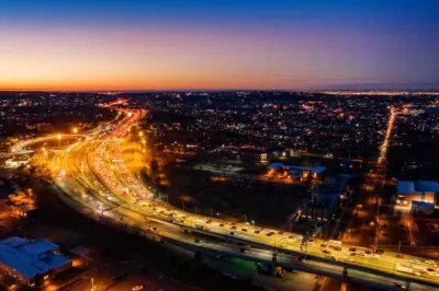
The New York State Department of Transportation (NYSDOT) recently announced the beginning of construction on a new westbound lane on the Staten Island Expressway, reports Erik Bascome. The new lane will be added between the northbound Martin Luther King Jr. Expressway entrance ramp and the South Avenue exit ramp.
NYSDOT Commissioner Marie Therese Dominguez is quoted in the article promising that the project will reduce congestion, both on the expressway and on adjacent local roadways.
"The approximately $3.3 million project will construct an additional lane to provide more time for vehicles to merge onto or exit the expressway, subsequently increasing vehicle capacity, improving mobility and significantly reducing traffic congestion along that stretch," writes Bascome.
The new auxiliary lane is the latest of hundreds of millions of dollars invested in improving the roadway and its entrances and exits, according to the article.
The article does not mention any criticism of the project from local groups or environmentalists, not does it mention the climate emissions the road will add to the transportation system, nor the possibility that induced demand will render obsolete the congestion relief promised by the project's supporters.
FULL STORY: New auxiliary lane coming to westbound Staten Island Expressway

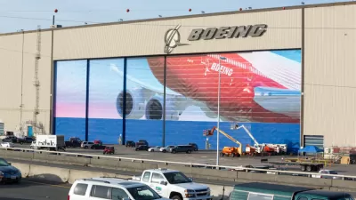
Widening, Other Improvements Planned for the 'Boeing Freeway'
The Washington State Department of Transportation is proposing a series of changes to State Route 526 that includes a new eastbound travel lane.
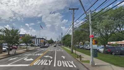
Staten Island Road Widening Project Moves Forward
New York’s Department of Transportation plans to double the width of a Staten Island street to accommodate more vehicular traffic.
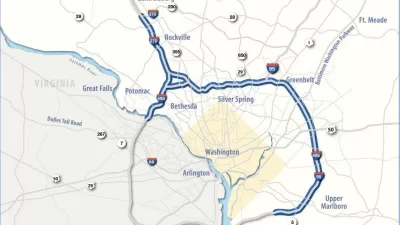
Maryland Highway Widening Plans Moving Forward Under New Governor
Maryland Governor Wes Moore is differentiating his new administration from his predecessor’s, but some projects, like the widening of federal highways in the Capital Beltway, stay the same.

Maui's Vacation Rental Debate Turns Ugly
Verbal attacks, misinformation campaigns and fistfights plague a high-stakes debate to convert thousands of vacation rentals into long-term housing.

Planetizen Federal Action Tracker
A weekly monitor of how Trump’s orders and actions are impacting planners and planning in America.

In Urban Planning, AI Prompting Could be the New Design Thinking
Creativity has long been key to great urban design. What if we see AI as our new creative partner?

How Trump's HUD Budget Proposal Would Harm Homelessness Response
Experts say the change to the HUD budget would make it more difficult to identify people who are homeless and connect them with services, and to prevent homelessness.

The Vast Potential of the Right-of-Way
One writer argues that the space between two building faces is the most important element of the built environment.

Florida Seniors Face Rising Homelessness Risk
High housing costs are pushing more seniors, many of them on a fixed income, into homelessness.
Urban Design for Planners 1: Software Tools
This six-course series explores essential urban design concepts using open source software and equips planners with the tools they need to participate fully in the urban design process.
Planning for Universal Design
Learn the tools for implementing Universal Design in planning regulations.
Gallatin County Department of Planning & Community Development
Heyer Gruel & Associates PA
JM Goldson LLC
City of Camden Redevelopment Agency
City of Astoria
Transportation Research & Education Center (TREC) at Portland State University
Jefferson Parish Government
Camden Redevelopment Agency
City of Claremont