


A loss for traffic safety advocates in Seattle.

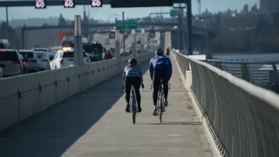
"The Seattle Department of Transportation (SDOT) has shelved plans for a safety improvement adjacent to Asa Mercer Middle School in Beacon Hill, the location of the most automatic tickets for speeding in school zones anywhere in the city during the last full school year," reports Ryan Packer.
"The project had been fully funded, and was selected by both Beacon Hill’s District Neighborhood Council and the Move Seattle Levy Oversight committee as a part of the 2016 Neighborhood Street Fund (NSF) program," explains Packer. Still, consensus on the design of the project was never reached. Objections first arose in 2017.
The source article includes a lot more detail on what the safety improvements might have looked like.
FULL STORY: Beacon Hill Safety Project Cancelled at Top Spot for Speeding Tickets Citywide

Seattle Road Safety Advocates Say Transportation Levy Perpetuates Car-Centric Status Quo
Critics of a proposed $1.3 billion transportation levy say the package isn’t enough to keep up with inflation and rising costs and fails to support a shift away from car-oriented infrastructure.
Traffic Camera Revenues to Fund Capacity-Building Programs in Washington State
Revenue from Washington's traffic enforcement cameras will go in part toward efforts to assist small communities in applying for grants and accessing funding opportunities.
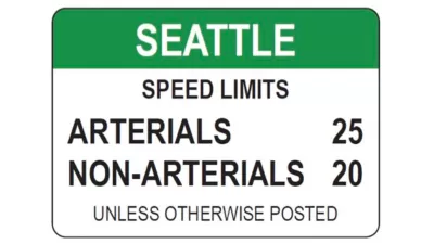
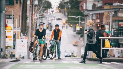
Seattle Expands Speed Limit Reductions
After an initial wave of speed limit reductions in 2016, the city of Seattle will embark on a major expansion of speed limit reductions over the next 18 months.

Montreal Mall to Become 6,000 Housing Units
Place Versailles will be transformed into a mixed-use complex over the next 25 years.

Planetizen Federal Action Tracker
A weekly monitor of how Trump’s orders and actions are impacting planners and planning in America.

DARTSpace Platform Streamlines Dallas TOD Application Process
The Dallas transit agency hopes a shorter permitting timeline will boost transit-oriented development around rail stations.

Chicago Judge Orders Thousands of Accessible Ped Signals
Only 3% of the city's crossing signals are currently accessible to blind pedestrians.

Philadelphia Swaps Car Lanes for Bikeways in Unanimous Vote
The project will transform one of the handful of streets responsible for 80% of the city’s major crashes.

Interactive Map Reveals America's “Shade Deserts”
Launched by UCLA and American Forests to combat heat-related deaths, the tool maps the shade infrastructure for over 360 U.S. cities.
Urban Design for Planners 1: Software Tools
This six-course series explores essential urban design concepts using open source software and equips planners with the tools they need to participate fully in the urban design process.
Planning for Universal Design
Learn the tools for implementing Universal Design in planning regulations.
City of Mt Shasta
City of Camden Redevelopment Agency
City of Astoria
Transportation Research & Education Center (TREC) at Portland State University
US High Speed Rail Association
City of Camden Redevelopment Agency
Municipality of Princeton (NJ)