


MTA reassured disoriented New Yorkers that it's flooding subway entrances on purpose, to test barriers that it hopes will guard the system against another Sandy.
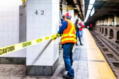
When one pedestrian passed an entrance to the New York subway's G train in South Williamsburg, "she saw something was very off," writes Zoe Schlanger. "The station entrance, a staircase leading underground, was completely flooded. The water level appeared so high as to be flush with the sidewalk."
When her photo went viral, the Metropolitan Transit Authority clarified that it's "testing a barrier that could seal off subway entrances in the event of another flood like the one that hit the city during Hurricane Sandy in 2012."
Schlanger notes that the 2012 hurricane inundated several subway lines, leading to a whopping $5 billion in damage. "The MTA explicitly draws the connection between storm surge preparedness and climate change in several of its projects," she reports. As the MTA put it, "We're doing this because climate change is real."
FULL STORY: New York City is flooding subway entrances to prepare for climate change

New York Needs Permeable Streets to Mitigate Future Flooding
To reduce the severity of disruptive subway flooding, the city can implement street-level solutions that absorb and redirect water before it reaches the train tunnels.
Federal Dollars Still Erasing Sandy's Footprint
Subway restoration and resilience efforts depend for a large part on federal relief. South Ferry Station, still new when the storm hit, will basically be rebuilt from scratch.

Connecticut Shoreline Rail Vulnerable to Floods
Long stretches of Connecticut's "lifeblood" shoreline rail line lie in the path of rising seas and future floods. While moving the tracks further inland is prohibitively expensive, a resilience plan is still needed.

Maui's Vacation Rental Debate Turns Ugly
Verbal attacks, misinformation campaigns and fistfights plague a high-stakes debate to convert thousands of vacation rentals into long-term housing.

Planetizen Federal Action Tracker
A weekly monitor of how Trump’s orders and actions are impacting planners and planning in America.

Chicago’s Ghost Rails
Just beneath the surface of the modern city lie the remnants of its expansive early 20th-century streetcar system.

Bend, Oregon Zoning Reforms Prioritize Small-Scale Housing
The city altered its zoning code to allow multi-family housing and eliminated parking mandates citywide.

Amtrak Cutting Jobs, Funding to High-Speed Rail
The agency plans to cut 10 percent of its workforce and has confirmed it will not fund new high-speed rail projects.

LA Denies Basic Services to Unhoused Residents
The city has repeatedly failed to respond to requests for trash pickup at encampment sites, and eliminated a program that provided mobile showers and toilets.
Urban Design for Planners 1: Software Tools
This six-course series explores essential urban design concepts using open source software and equips planners with the tools they need to participate fully in the urban design process.
Planning for Universal Design
Learn the tools for implementing Universal Design in planning regulations.
planning NEXT
Appalachian Highlands Housing Partners
Mpact (founded as Rail~Volution)
City of Camden Redevelopment Agency
City of Astoria
City of Portland
City of Laramie