


Transportation and land use are being considered together at a new scale in the Bay Area, as transit oriented development pops up next to BART stations all over the region.
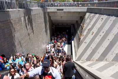
John King surveys the San Francisco Bay Area for examples of the transit-oriented building spree taking place near BART stations, like at MacArthur Station in Oakland:
A seven-story building with lime-green accents covers land that five years ago held parking lots. It’s part of a 385-unit apartment complex being marketed as “sleek and modern with a retro vibe ... perfect for your life on the go.” A few yards away, workers have nearly completed the concrete frame for a 24-story apartment tower that will open next spring.
In a feature story filed under "Bay Area Housing Crisis," King reports that projects have opened recently at seven East Bay BART stations, and projects at three more that could break ground soon. "Cities across the system are putting plans in place to allow bigger buildings near BART," writes King.
"Long touted by boosters as pedestrian-friendly 'transit villages,' such projects on BART-owned land are gaining traction as never before. The change is fueled by factors including the region’s incessant housing demand and a new state law that loosens development restrictions on BART property."
The idea of adding large buildings and large amounts of housing units to BART-adjacent properties has been occasionally controversial, but the recent development activity acts on planning goals set as long ago as 1972, and formalized by a formalized planning policy in 2005.
"The current policy, adopted in 2016, seeks to add up to 18,000 units by 2040, filling 250 acres at 27 stations," according to King. "It also sets a goal that 35% of these units should be reserved for below-market housing."
There is a lot more to see and consider in this big feature, with infographics, images, and soundbites that match the scale of the endeavor underway in the Bay Area.
FULL STORY: At home at BART

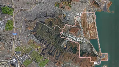
Voters Will Decide on Controversial Development Plans in Brisbane
A local issue with regional consequences: Measure JJ would approve a scaled back version of a development proposal at the Baylands site in the San Francisco suburb of Brisbane.
Texas Legislature’s Surprising Pro-Housing Swing
Smaller homes on smaller lots, office to apartment conversions, and 40% less say for NIMBYs, vote state lawmakers.
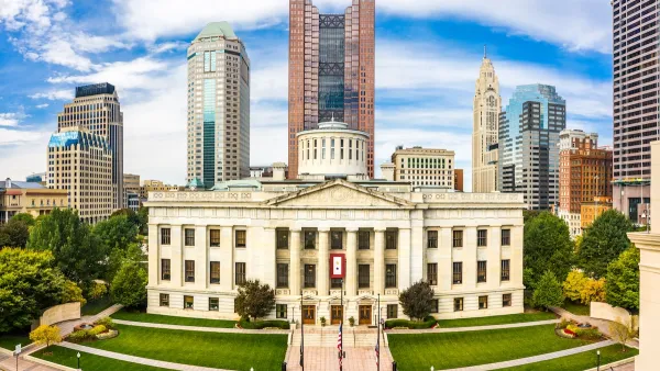
Proposed Ohio Budget Preserves Housing Trust Fund
The Senate-approved budget also creates two new programs aimed at encouraging housing construction.

Planetizen Federal Action Tracker
A weekly monitor of how Trump’s orders and actions are impacting planners and planning in America.

Chicago’s Ghost Rails
Just beneath the surface of the modern city lie the remnants of its expansive early 20th-century streetcar system.

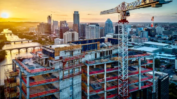
San Antonio and Austin are Fusing Into one Massive Megaregion
The region spanning the two central Texas cities is growing fast, posing challenges for local infrastructure and water supplies.

Since Zion's Shuttles Went Electric “The Smog is Gone”
Visitors to Zion National Park can enjoy the canyon via the nation’s first fully electric park shuttle system.

Trump Distributing DOT Safety Funds at 1/10 Rate of Biden
Funds for Safe Streets and other transportation safety and equity programs are being held up by administrative reviews and conflicts with the Trump administration’s priorities.

German Cities Subsidize Taxis for Women Amid Wave of Violence
Free or low-cost taxi rides can help women navigate cities more safely, but critics say the programs don't address the root causes of violence against women.
Urban Design for Planners 1: Software Tools
This six-course series explores essential urban design concepts using open source software and equips planners with the tools they need to participate fully in the urban design process.
Planning for Universal Design
Learn the tools for implementing Universal Design in planning regulations.
planning NEXT
Appalachian Highlands Housing Partners
Mpact (founded as Rail~Volution)
City of Camden Redevelopment Agency
City of Astoria
City of Portland
City of Laramie