


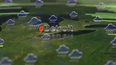
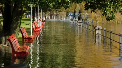
Water is encroaching on neighborhoods and shorelines in Detroit at rare levels. Those impacts and many more are considered only a preview of what's to come when the worst effects of climate change strike the Great Lakes region.
"Anyone who doubts that climate change could deliver a nasty shock to Michigan's economy need only take a stroll along the Detroit riverfront these days," according to an article by John Gallagher.
Experts disagree whether high lake levels and heavy rains that have been the reality of the spring and summer in Michigan can be directly traced to climate change, according to Gallagher, but experts do agree that the worst of climate change is yet to come. And that means, "the kind of problems we're seeing now because of high lake levels and abundant spring rainfall give a hint to what Michigan will endure from full-blown climate change one day."
Detroit has been sandbagging properties in the Jefferson-Chalmers neighborhood on the far lowest east side. "And far from the Detroit River and Lake St. Clair, Michigan farmers have been dealing with soggy fields produced by the spring downpours," according to Gallagher.
FULL STORY: High water levels foreshadow huge cost of climate change in Michigan

Flooding in the Midwest Shows There's No Refuge From Climate Change
While projections say areas of the U.S. Midwest around the Great Lakes will become more hospitable as the climate changes, stormwater and flooding is still a challenge in a surprising number of locations.
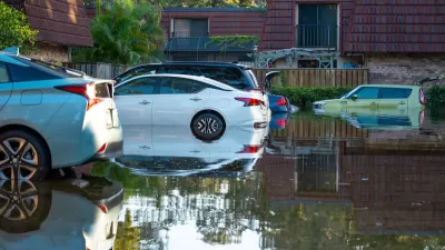
Detroit Floods as the Pacific Northwest Bakes: It's Time to Shift the Conversation About Climate Change
The record-breaking heatwave in the Pacific Northwest has mostly been depicted in the media by kids running through fountains, but images of flooded highways and stranded vehicles in Detroit tell a more accurate story of climate change.
Auto Insurance Rates Spike Due to Extreme Weather
Car insurance costs around the country are going up as insurers receive more claims from areas struck by storms and other climate disasters.

Planetizen Federal Action Tracker
A weekly monitor of how Trump’s orders and actions are impacting planners and planning in America.

Maui's Vacation Rental Debate Turns Ugly
Verbal attacks, misinformation campaigns and fistfights plague a high-stakes debate to convert thousands of vacation rentals into long-term housing.

Restaurant Patios Were a Pandemic Win — Why Were They so Hard to Keep?
Social distancing requirements and changes in travel patterns prompted cities to pilot new uses for street and sidewalk space. Then it got complicated.

In California Battle of Housing vs. Environment, Housing Just Won
A new state law significantly limits the power of CEQA, an environmental review law that served as a powerful tool for blocking new development.

Boulder Eliminates Parking Minimums Citywide
Officials estimate the cost of building a single underground parking space at up to $100,000.

Orange County, Florida Adopts Largest US “Sprawl Repair” Code
The ‘Orange Code’ seeks to rectify decades of sprawl-inducing, car-oriented development.
Urban Design for Planners 1: Software Tools
This six-course series explores essential urban design concepts using open source software and equips planners with the tools they need to participate fully in the urban design process.
Planning for Universal Design
Learn the tools for implementing Universal Design in planning regulations.
Heyer Gruel & Associates PA
JM Goldson LLC
Custer County Colorado
City of Camden Redevelopment Agency
City of Astoria
Transportation Research & Education Center (TREC) at Portland State University
Jefferson Parish Government
Camden Redevelopment Agency
City of Claremont