


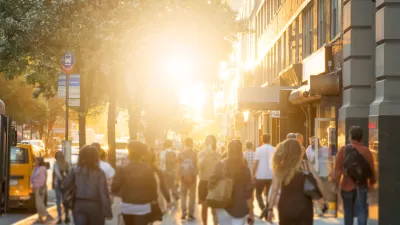
Brookings buils on the findings of recent research about jobs densification in cities around the country to make a larger point about the benefits of proximity in urban design, as compared to sprawl.

"New research from the Bass Center for Transformative Placemaking at Brookings confirms that when it comes to site selection, American businesses continue to value proximity."
Adie Tomer, Joseph W. Kane, and Lara Fishbane write to explain the findings of the research referenced above, tying transportation and land use planning to the discussion as the "ultimate enablers of proximity."
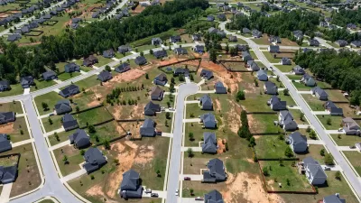
"The character of our urban form—including density, permitted use in buildings, and transportation designs—will either promote closer proximity or push economic activity further apart. And despite the best efforts of many business and civic leaders, the prevailing transportation model in the United States downplays distance and focuses too much on traffic," according to the article.
Earlier this month, Planetizen picked up the news of the research cited here, but the current article more explicitly ties the findings of the study to planning policies and more explicitly appeals for a shift toward less car-oriented sprawl.
"We propose a new model: prioritizing human-scale proximity and the shorter-distance travel it promotes," according to the article, before laying out a list of five benefits to more proximity and less sprawl, with more detail in the source article:
- Proximity promotes agglomeration, helping to grow industries and regional economies.
- Proximity requires less infrastructure per capita, reducing fiscal burdens on communities.
- Proximity offers more modal choice, making transportation more affordable and age-neutral.
- Proximity is essential to hitting carbon targets and developing more resilient places.
- Proximity incentivizes safer streets and supports a healthier population.
The article also includes one critical caveat: the proposal does not necessitate a Cobursian approach to urban development that would replicate skyscrapers all over urban areas. To get at the right mix of densities, the trio of writers suggests making better use of the new troves of transportation data available to planners.
FULL STORY: Connecting people by proximity: A better way to plan metro areas

Density and Disorder: The Imaginary Link
A recent article tries to tie public transit and walkability to social disorder — but in fact, sprawling Sunbelt cities like Memphis are as likely to have high crime rates as transit-rich metropolises such as New York and San Francisco.
Commentary: We Need a Return to the Adaptability of Traditional Urban Form
How the rigidity of modern suburban development fails to prepare cities for the future.
Commentary: Minimum Lot Sizes Drive Up Housing Costs
How making residential building requirements more flexible can ease the housing crisis and make neighborhoods more livable for more households.

Planetizen Federal Action Tracker
A weekly monitor of how Trump’s orders and actions are impacting planners and planning in America.

San Francisco's School District Spent $105M To Build Affordable Housing for Teachers — And That's Just the Beginning
SFUSD joins a growing list of school districts using their land holdings to address housing affordability challenges faced by their own employees.

Can We Please Give Communities the Design They Deserve?
Often an afterthought, graphic design impacts everything from how we navigate a city to how we feel about it. One designer argues: the people deserve better.

The EV “Charging Divide” Plaguing Rural America
With “the deck stacked” against rural areas, will the great electric American road trip ever be a reality?

Judge Halts Brooklyn Bike Lane Removal
Lawyers must prove the city was not acting “arbitrarily, capriciously, and illegally” in ordering the hasty removal.

Engineers Gave America's Roads an Almost Failing Grade — Why Aren't We Fixing Them?
With over a trillion dollars spent on roads that are still falling apart, advocates propose a new “fix it first” framework.
Urban Design for Planners 1: Software Tools
This six-course series explores essential urban design concepts using open source software and equips planners with the tools they need to participate fully in the urban design process.
Planning for Universal Design
Learn the tools for implementing Universal Design in planning regulations.
Borough of Carlisle
Smith Gee Studio
City of Camden Redevelopment Agency
City of Astoria
Transportation Research & Education Center (TREC) at Portland State University
City of Camden Redevelopment Agency
Municipality of Princeton (NJ)