


The city of St. Petersburg is intended to improve safety for all users of streets—bicyclists, pedestrians, transit users, and drivers.

St. Petersburg, Florida has approved a new complete streets plan to guide street design and engineering for the next 20 years.
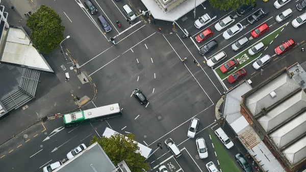
Kate Pyzyk shares details of the city's Complete Streets Implementation Plan [pdf], which updates a 2015 plan and will receive additional updates every five years.
"St. Petersburg's plan addresses needs in the city's motor vehicle, transit, trail, sidewalk and bicycle infrastructure networks. It includes key steps such as adding bike lanes, crosswalks and a bus rapid transit line, as well as increasing the use of data to improve traffic safety," according to Pyzyk.
According to a press release from the city announcing the approval of the implementation plan, the city has recently completed a pair of projects under the complete streets umbrella: "resurfacing and reconfiguration of Dr. Martin Luther King Jr. Street and bike improvements along the 30thAve. corridor."
FULL STORY: St. Petersburg, FL approves complete streets plan

How Understanding Near-Misses Can Improve Road Safety
Most road safety efforts are based on data about crashes that have already occurred. But important information can be gleaned from incidents when something almost went wrong, but didn’t.

Vehicle-related Deaths Drop 29% in Richmond, VA
The seventh year of the city's Vision Zero strategy also cut the number of people killed in alcohol-related crashes by half.

Maryland Plans Quick-Build Complete Streets Projects
The state will use low-cost interventions to improve road safety in five Maryland counties.

Planetizen Federal Action Tracker
A weekly monitor of how Trump’s orders and actions are impacting planners and planning in America.

Restaurant Patios Were a Pandemic Win — Why Were They so Hard to Keep?
Social distancing requirements and changes in travel patterns prompted cities to pilot new uses for street and sidewalk space. Then it got complicated.

Map: Where Senate Republicans Want to Sell Your Public Lands
For public land advocates, the Senate Republicans’ proposal to sell millions of acres of public land in the West is “the biggest fight of their careers.”

Maui's Vacation Rental Debate Turns Ugly
Verbal attacks, misinformation campaigns and fistfights plague a high-stakes debate to convert thousands of vacation rentals into long-term housing.

San Francisco Suspends Traffic Calming Amidst Record Deaths
Citing “a challenging fiscal landscape,” the city will cease the program on the heels of 42 traffic deaths, including 24 pedestrians.

California Homeless Arrests, Citations Spike After Ruling
An investigation reveals that anti-homeless actions increased up to 500% after Grants Pass v. Johnson — even in cities claiming no policy change.
Urban Design for Planners 1: Software Tools
This six-course series explores essential urban design concepts using open source software and equips planners with the tools they need to participate fully in the urban design process.
Planning for Universal Design
Learn the tools for implementing Universal Design in planning regulations.
Heyer Gruel & Associates PA
JM Goldson LLC
Custer County Colorado
City of Camden Redevelopment Agency
City of Astoria
Transportation Research & Education Center (TREC) at Portland State University
Camden Redevelopment Agency
City of Claremont
Municipality of Princeton (NJ)