


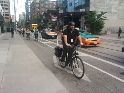
A pilot project of cycle tracks on several streets in Toronto produced almost shockingly positive results for all users of the street. At very little cost, the new bike infrastructure increased total street capacity and improved safety.
A report by the city of Toronto to evaluate the performance of cycle tracks on Richmond Street and Adelaide Street, as well as north-south cycle tracks on Simcoe Street and Peter Street, recommends converting the temporary installations to permanent infrastructure facilities.
The report "tells a commuting story of roaring success that was accomplished with little fanfare and even less cost," according to an article by Edward Keenan. According to the report, 730 people biked on Richmond and Adelaide streets before the temporary cycle tracks were installed in 2014. In 2018, that number had increased to 7,509 people biking on the streets every day.
"The city also monitored bike traffic on nearby streets to see if the change was a result of people taking the new lanes instead of travelling on King or Queen Sts," adds Keenan. "It found the decreases in cycle traffic on those roads was minimal, 'suggesting that 94 per cent of the growth in the number of cyclists on Richmond-Adelaide was as a result of new cyclists, shifting their transportation choice from another mode.'"
One final piece of smashing success to note here: "In the downtown core area, the bike lanes now carry almost a third of the vehicles travelling the road during the peak of rush hour, 'a higher volume of vehicles per lane than the motor vehicle lanes.'"
Additional data on improved safety and a lack of impact on trip times for cars are included in the article.
FULL STORY: Bike lanes prove that transportation solutions can be cheap and effective

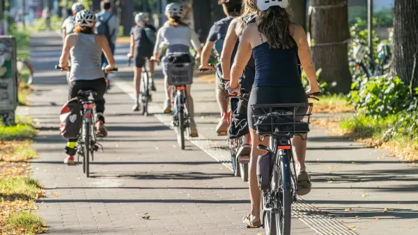
With Protected Lanes, 460% More People Commute by Bike
For those needing more ammo, more data proving what we already knew is here.
DC Backpedals on Bike Lane Protection, Swaps Barriers for Paint
Citing aesthetic concerns, the city is removing the concrete barriers and flexposts that once separated Arizona Avenue cyclists from motor vehicles.
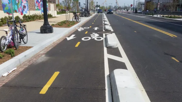
Downtown Cleveland Gets First Ever Protected Bike Lanes
The $200,000 “quick build” lanes are the first of 50 planned miles over five years.

Maui's Vacation Rental Debate Turns Ugly
Verbal attacks, misinformation campaigns and fistfights plague a high-stakes debate to convert thousands of vacation rentals into long-term housing.

Planetizen Federal Action Tracker
A weekly monitor of how Trump’s orders and actions are impacting planners and planning in America.

San Francisco Suspends Traffic Calming Amidst Record Deaths
Citing “a challenging fiscal landscape,” the city will cease the program on the heels of 42 traffic deaths, including 24 pedestrians.

Defunct Pittsburgh Power Plant to Become Residential Tower
A decommissioned steam heat plant will be redeveloped into almost 100 affordable housing units.

Trump Prompts Restructuring of Transportation Research Board in “Unprecedented Overreach”
The TRB has eliminated more than half of its committees including those focused on climate, equity, and cities.

Amtrak Rolls Out New Orleans to Alabama “Mardi Gras” Train
The new service will operate morning and evening departures between Mobile and New Orleans.
Urban Design for Planners 1: Software Tools
This six-course series explores essential urban design concepts using open source software and equips planners with the tools they need to participate fully in the urban design process.
Planning for Universal Design
Learn the tools for implementing Universal Design in planning regulations.
Heyer Gruel & Associates PA
JM Goldson LLC
Custer County Colorado
City of Camden Redevelopment Agency
City of Astoria
Transportation Research & Education Center (TREC) at Portland State University
Jefferson Parish Government
Camden Redevelopment Agency
City of Claremont