


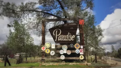
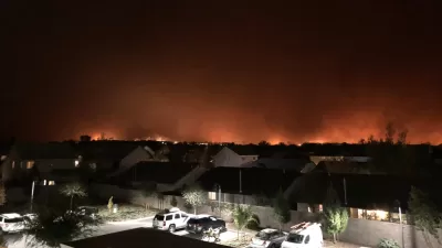
The planning history of Paradise, California is blamed for the destruction of the city in the Camp Fire. Can planners find new models for both limiting carbon emissions and preparing for the effects of climate change?
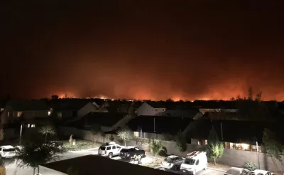
A bombshell feature by the reporting team of Paige St. John, Joseph Serna, and Rong-Gong Lin II reveals the role of poor planning in the destruction and carnage of the Camp Fire in the city of Paradise, California in November.
Without flinching, the beginning of the story sets the stage in stark terms:
The fate of Paradise was cast long before a windstorm last month fueled the deadliest fire in California history.
The ridge settlement was doomed by its proximity to a crack in the mighty wall of the Sierra Nevada, a deep canyon that bellowed gale-force winds.
It was doomed by its maze of haphazard lanes and dead-end roads that paid no heed to escape.
An earlier article published in the Los Angeles Times about how the city's emergency preparation saved potentially thousands of lives is quickly swept under the rug in this telling of the story of the Camp Fire. This Los Angeles Times investigation "found that Paradise ignored repeated warnings of the risk its residents faced, crafted no plan to evacuate the area all at once, entrusted public alerts to a system vulnerable to fire, and did not sound citywide orders to flee even as a hail of fire rained down."
The most damning findings of this investigation are directed toward the land use and transportation concepts that both placed the city in harm's way and then cut off residents from reasonable hope of escape. One potentially contentious focus of the investigation is a nearly decade-old project to narrow the main evacuation route in the city, the Skyway, due to concerns about a spate of pedestrian injuries.
FULL STORY: Here's how Paradise ignored warnings and became a deathtrap

Planning for the Worst May Have Saved Thousands in the Camp Fire
The city of Paradise was prepared for the Camp Fire when it ripped through the town last week, and it still wasn't enough to save everyone.
Paradise Was Prepared for the Camp Fire, Report Says. It Wasn't Enough.
Sobering findings from a thorough examination of the causes of the 2018 Camp Fire.

How To Protect an Entire Town From Wildfire
In the wake of the destructive Camp Fire, a proposal to encircle the town of Paradise with a green belt could help keep future fires at bay and better protect vulnerable residents.

Maui's Vacation Rental Debate Turns Ugly
Verbal attacks, misinformation campaigns and fistfights plague a high-stakes debate to convert thousands of vacation rentals into long-term housing.

Planetizen Federal Action Tracker
A weekly monitor of how Trump’s orders and actions are impacting planners and planning in America.

San Francisco Suspends Traffic Calming Amidst Record Deaths
Citing “a challenging fiscal landscape,” the city will cease the program on the heels of 42 traffic deaths, including 24 pedestrians.

Defunct Pittsburgh Power Plant to Become Residential Tower
A decommissioned steam heat plant will be redeveloped into almost 100 affordable housing units.

Trump Prompts Restructuring of Transportation Research Board in “Unprecedented Overreach”
The TRB has eliminated more than half of its committees including those focused on climate, equity, and cities.

Amtrak Rolls Out New Orleans to Alabama “Mardi Gras” Train
The new service will operate morning and evening departures between Mobile and New Orleans.
Urban Design for Planners 1: Software Tools
This six-course series explores essential urban design concepts using open source software and equips planners with the tools they need to participate fully in the urban design process.
Planning for Universal Design
Learn the tools for implementing Universal Design in planning regulations.
Heyer Gruel & Associates PA
JM Goldson LLC
Custer County Colorado
City of Camden Redevelopment Agency
City of Astoria
Transportation Research & Education Center (TREC) at Portland State University
Jefferson Parish Government
Camden Redevelopment Agency
City of Claremont