


Former chief planner Jennifer Keesmaat wants to transform three failing golf courses into free public spaces.
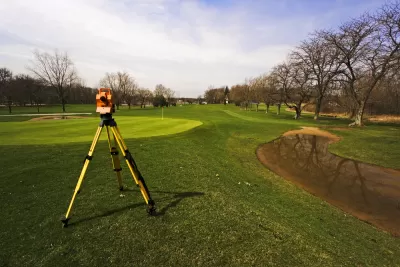
"Mayoral candidate and former Toronto chief planner Jennifer Keesmaat announced a new proposal to convert three city-owned golf courses into publicly-accessible spaces intended to be open year-round," Ilya Bañares reports for The Toronto Star.
Toronto's 2018-2026 capital plan dedicates about $10 million to improve the courses, none of which is heavily used. All three are located near major transit routes in North York, Roselands, and Oakridge, respectively.
"Highest and best use of public land means opening it up to more uses by more people," Keesmaat said. Her proposal would convert all three properties to uses to be determined by community planning processes, as long as they remain free and open to the public.
All city-owned and operated golf courses are under review following a January vote by the Toronto City Council. Ecologists suggest restoring the courses to green space could mitigate flooding and improve the city's tree canopy, as well as create recreational opportunities for residents.
FULL STORY: Jennifer Keesmaat wants to transform city-owned golf courses into public spaces

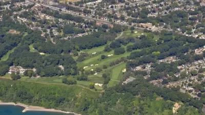
Toronto Searching for a Future for its Public Golf Courses
Amid calls to convert the city's golf courses to other uses, Toronto, Ontario city staff are trying to figure out a middle ground between competing interests.

How South LA Green Spaces Power Community Health and Hope
Green spaces like South L.A. Wetlands Park are helping South Los Angeles residents promote healthy lifestyles, build community, and advocate for improvements that reflect local needs in historically underserved neighborhoods.
The Most Popular Tree on Google?
Meet Rodney: the Toronto tree getting rave reviews.

Planetizen Federal Action Tracker
A weekly monitor of how Trump’s orders and actions are impacting planners and planning in America.

Map: Where Senate Republicans Want to Sell Your Public Lands
For public land advocates, the Senate Republicans’ proposal to sell millions of acres of public land in the West is “the biggest fight of their careers.”

Restaurant Patios Were a Pandemic Win — Why Were They so Hard to Keep?
Social distancing requirements and changes in travel patterns prompted cities to pilot new uses for street and sidewalk space. Then it got complicated.

Platform Pilsner: Vancouver Transit Agency Releases... a Beer?
TransLink will receive a portion of every sale of the four-pack.

Toronto Weighs Cheaper Transit, Parking Hikes for Major Events
Special event rates would take effect during large festivals, sports games and concerts to ‘discourage driving, manage congestion and free up space for transit.”

Berlin to Consider Car-Free Zone Larger Than Manhattan
The area bound by the 22-mile Ringbahn would still allow 12 uses of a private automobile per year per person, and several other exemptions.
Urban Design for Planners 1: Software Tools
This six-course series explores essential urban design concepts using open source software and equips planners with the tools they need to participate fully in the urban design process.
Planning for Universal Design
Learn the tools for implementing Universal Design in planning regulations.
Heyer Gruel & Associates PA
JM Goldson LLC
Custer County Colorado
City of Camden Redevelopment Agency
City of Astoria
Transportation Research & Education Center (TREC) at Portland State University
Camden Redevelopment Agency
City of Claremont
Municipality of Princeton (NJ)