


Revisiting one day in 2012, a reporter finds that many of the Dallas-Fort Worth areas affected by the storms were barely inhabited 20 years ago.
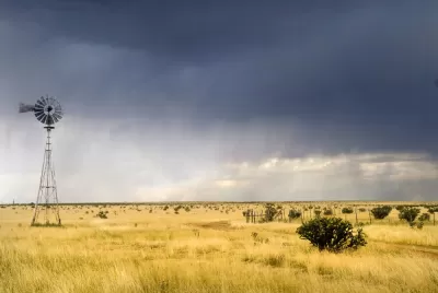
At the Texas Tribune, Daniel Levy recounts one day in 2012 during which 17 tornadoes caused $700 million in damages across the Dallas-Fort Worth area. It’s partly memorable for the 110 airplanes taken out, but it’s also memorable because it demonstrates how sprawl makes people and places more vulnerable to natural disasters.
The strongest tornado of the day struck Forney, a suburb 20 miles east of downtown Dallas. Forney has grown by more than 230 percent since 2000, adding 13,000 residents. At 2:33 p.m., an EF-3 tornado with peak winds of 170 mph tore through more neighborhoods, including the Diamond Creek subdivision, that didn’t exist a decade before.
The article includes a map showing the various paths of the various tornadoes; it demonstrates that many of them of them started, ended or passed through areas that have only been developed in the last 20 years, and others passed through areas that will likely be developed in the next 20.
FULL STORY: As cities sprawl, more Texans are exposed to tornadoes

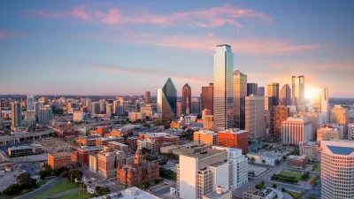
Dallas Code Reform Makes Way for Missing Middle Housing
The Dallas City Council voted to change the city’s building code to allow up to eight residential units in three-story buildings.
Zoning for Good
A new book highlights the power of zoning to change communities for the better.
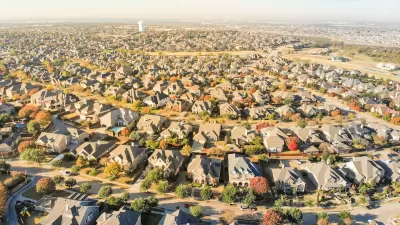
Is Sprawl the Only Answer to High Housing Costs?
A recent article argues that sprawl is the solution to high housing costs, pointing out that low-density Sunbelt cities are more affordable than some more compact metro areas. What's wrong with this argument?

Planetizen Federal Action Tracker
A weekly monitor of how Trump’s orders and actions are impacting planners and planning in America.

Restaurant Patios Were a Pandemic Win — Why Were They so Hard to Keep?
Social distancing requirements and changes in travel patterns prompted cities to pilot new uses for street and sidewalk space. Then it got complicated.

Map: Where Senate Republicans Want to Sell Your Public Lands
For public land advocates, the Senate Republicans’ proposal to sell millions of acres of public land in the West is “the biggest fight of their careers.”

Maui's Vacation Rental Debate Turns Ugly
Verbal attacks, misinformation campaigns and fistfights plague a high-stakes debate to convert thousands of vacation rentals into long-term housing.

San Francisco Suspends Traffic Calming Amidst Record Deaths
Citing “a challenging fiscal landscape,” the city will cease the program on the heels of 42 traffic deaths, including 24 pedestrians.

California Homeless Arrests, Citations Spike After Ruling
An investigation reveals that anti-homeless actions increased up to 500% after Grants Pass v. Johnson — even in cities claiming no policy change.
Urban Design for Planners 1: Software Tools
This six-course series explores essential urban design concepts using open source software and equips planners with the tools they need to participate fully in the urban design process.
Planning for Universal Design
Learn the tools for implementing Universal Design in planning regulations.
Heyer Gruel & Associates PA
JM Goldson LLC
Custer County Colorado
City of Camden Redevelopment Agency
City of Astoria
Transportation Research & Education Center (TREC) at Portland State University
Camden Redevelopment Agency
City of Claremont
Municipality of Princeton (NJ)