


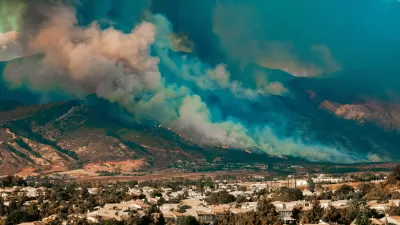
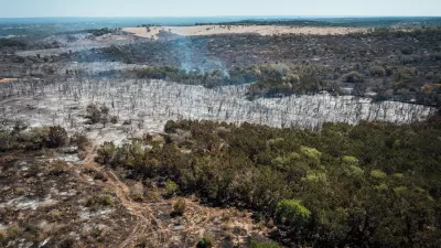
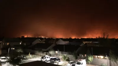
Wildfires tend to start at the Wildland-Urban Interface: those border zones between cities and the open land surrounding them. Keeping the lid on sprawl, it can be argued, would tame the inferno.
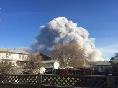
As another summer of wildfires blazes on, it's hard not to notice the types of neighborhoods they regularly threaten. Adam Rogers writes, "The key to how we think about fire's severity [...] is not the number of fires, or even their magnitude, but where they are—and what's near them."
In fire-prone states like California, Texas, and Colorado, suburban sprawl often occupies the Wildland-Urban Interface (WUI) where wildfires often start. "Humans set most wildfires—95 percent of them, according to CalFire. That's a real problem when, as of 2004 in the continental US, the WUI was almost 278,000 square miles and contained 44.8 million housing units."
In a sense, the urban housing crisis exacerbates our risk from fire, and those affected are those priced out. "At a time when cities all over the country are experiencing housing crises, unable or unwilling to build enough units to accommodate growing populations, the greatest expansion of houses is on previously unbuilt spaces at the edges of cities."
FULL STORY: The West Is on Fire. Blame the Housing Crisis

Home Insurers Are Fleeing California
Homeowners in the state are finding it increasingly difficult to secure insurance policies thanks to the growing risks of wildfire, drought, and other climate threats.
As Central Texas Population Grows, So Does Fire Risk
Sprawl in and around Austin is contributing to growing wildfire risks, and local officials worry about a lack of public awareness of the issue.
Between a Rock and a Hard Place: Housing and Fire Safety in California
A proposed development near the site of the devastating Camp Fire highlights the growing tension between building badly needed housing and protecting communities from heightened wildfire risk.

Maui's Vacation Rental Debate Turns Ugly
Verbal attacks, misinformation campaigns and fistfights plague a high-stakes debate to convert thousands of vacation rentals into long-term housing.

Planetizen Federal Action Tracker
A weekly monitor of how Trump’s orders and actions are impacting planners and planning in America.

In Urban Planning, AI Prompting Could be the New Design Thinking
Creativity has long been key to great urban design. What if we see AI as our new creative partner?

King County Supportive Housing Program Offers Hope for Unhoused Residents
The county is taking a ‘Housing First’ approach that prioritizes getting people into housing, then offering wraparound supportive services.

Researchers Use AI to Get Clearer Picture of US Housing
Analysts are using artificial intelligence to supercharge their research by allowing them to comb through data faster. Though these AI tools can be error prone, they save time and housing researchers are optimistic about the future.

Making Shared Micromobility More Inclusive
Cities and shared mobility system operators can do more to include people with disabilities in planning and operations, per a new report.
Urban Design for Planners 1: Software Tools
This six-course series explores essential urban design concepts using open source software and equips planners with the tools they need to participate fully in the urban design process.
Planning for Universal Design
Learn the tools for implementing Universal Design in planning regulations.
planning NEXT
Appalachian Highlands Housing Partners
Mpact (founded as Rail~Volution)
City of Camden Redevelopment Agency
City of Astoria
City of Portland
City of Laramie