


The most recent post-Harvey proposal would mean the city could endure enormous rain events, but so far it's not clear who would pay for it.
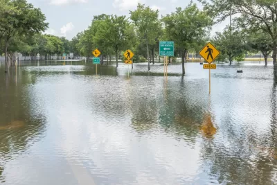
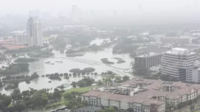
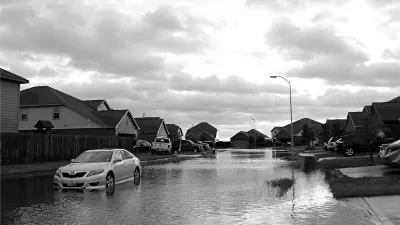
Nearly seven months after Hurricane Harvey spilled 50 inches of water onto the Gulf Coast of Texas, the Harris County Flood Control District has proposed building "massive, underground tunnels to carry flood waters from several Houston-area bayous toward the Houston Ship Channel."
Houston was plagued by flooding long before Harvey, so this multi-billion-dollar project would be in addition to plans to make the bayous more flood-proof that were in the works long before Harvey, and which have been expedited in the wake of the storm.
Those projects have all been partnerships between the HCFCD and the U.S. Army Corps of Engineers; so far it's not clear who would pay for the new tunnel project, but director of operations tells the Houston Chronicle "the district hopes to work with the Federal Emergency Management Agency and the state to possibly help pay for it."
Houston has given a great deal of consideration to flood control since the biggest flooding event in its history; the city is redrawing the flood maps, rethinking flood insurance, and considering more green infrastructure to manage stormwater in the future.
FULL STORY: Flood control district exploring plan to build massive tunnels to carry away stormwater


Harris County Will Use Toll Road Revenue to Pay for Flood Control
A new Flood Resilience Trust will create a permanent source of funding for flood control purposes, but the county still faces a shortfall for planned projects.
Houston Seriously Tightens Rules on Floodplain Construction
It was the city's "first major regulatory response" to Hurricane Harvey.
After Harvey, Texas Tries State-Run Disaster Relief, With Mixed Results
The scale of the housing recovery effort means some jobs normally handles by FEMA have fallen to the Texas General Land Office.

Maui's Vacation Rental Debate Turns Ugly
Verbal attacks, misinformation campaigns and fistfights plague a high-stakes debate to convert thousands of vacation rentals into long-term housing.

Planetizen Federal Action Tracker
A weekly monitor of how Trump’s orders and actions are impacting planners and planning in America.

In Urban Planning, AI Prompting Could be the New Design Thinking
Creativity has long been key to great urban design. What if we see AI as our new creative partner?

Pedestrian Deaths Drop, Remain Twice as High as in 2009
Fatalities declined by 4 percent in 2024, but the U.S. is still nowhere close to ‘Vision Zero.’

King County Supportive Housing Program Offers Hope for Unhoused Residents
The county is taking a ‘Housing First’ approach that prioritizes getting people into housing, then offering wraparound supportive services.

Researchers Use AI to Get Clearer Picture of US Housing
Analysts are using artificial intelligence to supercharge their research by allowing them to comb through data faster. Though these AI tools can be error prone, they save time and housing researchers are optimistic about the future.
Urban Design for Planners 1: Software Tools
This six-course series explores essential urban design concepts using open source software and equips planners with the tools they need to participate fully in the urban design process.
Planning for Universal Design
Learn the tools for implementing Universal Design in planning regulations.
planning NEXT
Appalachian Highlands Housing Partners
Mpact (founded as Rail~Volution)
City of Camden Redevelopment Agency
City of Astoria
City of Portland
City of Laramie