


It was the city's "first major regulatory response" to Hurricane Harvey.
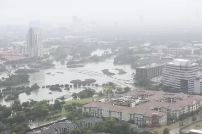
Last week, in an "unusually tight" vote, the Houston City Council ruled that starting in September, "all new construction in the city’s floodplains will have to be built two feet above the projected water level in a 500-year storm." Under current rules, it's only one foot, and from only the 100-year level.
"The vote marks a shift away from Houston’s longtime aversion to constraining," writes Rebecca Elliot, who also reports that the vote was largely along party lines—as well as supported by the mayor.
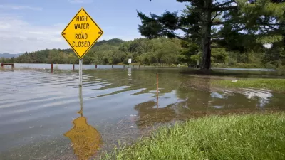
Harris County started using the 500- year floodplain in January, but entire region's distaste for regulation has been a popular topic of conversation in the months since Hurricane Harvey, which according to some studies was more like a 1,000-year storm.
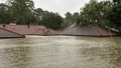
It might seem unwise, after Harvey, tokeep building in the floodplain at all, but the city's real estate market barely paused in the wake of the massive storm, and buyers of both new and old structures will still be protected by the National Flood Insurance Program.
FULL STORY: City Council adopts stricter development rules for Houston’s floodplains


800 New Homes Approved for Houston's Floodplain
The city of Houston approved a new development that doesn't meet new elevations standards approved by the city of Houston earlier this month.
Houston-Area Floodplain Regulations to Expand from 100-Year to 500-Year Levels
Harris County, home to Houston and the scene of widespread devastation during Hurricane Harvey and other weather events, will make large-scale changes to development regulations on floodplains for the first time in almost 20 years.
Connecting the Issues of Flooding and Affordable Housing in Texas
A study released this week by the Greater Houston Flood Mitigation Consortium ( the University of Houston, the Kinder Institute, the Local Initiatives Support Corporation, and more) raises concerns that new floodplain regulations could harm renters.

Maui's Vacation Rental Debate Turns Ugly
Verbal attacks, misinformation campaigns and fistfights plague a high-stakes debate to convert thousands of vacation rentals into long-term housing.

Planetizen Federal Action Tracker
A weekly monitor of how Trump’s orders and actions are impacting planners and planning in America.

Chicago’s Ghost Rails
Just beneath the surface of the modern city lie the remnants of its expansive early 20th-century streetcar system.

Bend, Oregon Zoning Reforms Prioritize Small-Scale Housing
The city altered its zoning code to allow multi-family housing and eliminated parking mandates citywide.

Amtrak Cutting Jobs, Funding to High-Speed Rail
The agency plans to cut 10 percent of its workforce and has confirmed it will not fund new high-speed rail projects.

LA Denies Basic Services to Unhoused Residents
The city has repeatedly failed to respond to requests for trash pickup at encampment sites, and eliminated a program that provided mobile showers and toilets.
Urban Design for Planners 1: Software Tools
This six-course series explores essential urban design concepts using open source software and equips planners with the tools they need to participate fully in the urban design process.
Planning for Universal Design
Learn the tools for implementing Universal Design in planning regulations.
planning NEXT
Appalachian Highlands Housing Partners
Mpact (founded as Rail~Volution)
City of Camden Redevelopment Agency
City of Astoria
City of Portland
City of Laramie