


Two county transit agencies, seven cities, and three regional transit agencies are joining forces to plan improvements to the growing San Pablo corridor in the East Bay Area.

The Alameda County Transportation Commission and the West Contra Costa Transportation Advisory Committee agencies are studying a growth plan for a corridor connecting the most densely populated cities in the East Bay Area.
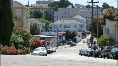
Chris Treadway reports on the San Pablo Avenue Multimodal Corridor, which connects San Pablo to Oakland—passing through Richmond, El Cerrito, Albany, Berkeley, and Emeryville along the way. project planners are currently circulating an online survey to gather feedback from the public.
The $300 million-plus project along the state highway is considering "short-term projects to improve the safety and experience of all users," as the corridor continues to add development designed to "increase foot, motor and bicycle traffic."
FULL STORY: Counties target San Pablo Avenue corridor with $312 million project

Oakland Wants to Make Space for Fourplexes
The city of Oakland in the East Bay Area is a hotbed of planning and development issues, most notably gentrification and the displacement of communities of color. Now the city is considering a drastic change to its zoning code.
Second Largest Bikeshare in U.S. will be Bay Area's by 2017
Bay Area Bike Share will grow from 700 to 7,000 bikes by 2017 after the expansion proposal was approved by a unanimous vote of the Metropolitan Transportation Commission. It is a regional, not a city program, though most usage is in San Francisco.
Bay Area Bike Share Poised to Grow from 700 to 7,000 Bikes
The regional system would expand to the the East Bay cities of Berkeley, Oakland and Emeryville. Bikes would be added in San Jose and San Francisco.

Planetizen Federal Action Tracker
A weekly monitor of how Trump’s orders and actions are impacting planners and planning in America.

Chicago’s Ghost Rails
Just beneath the surface of the modern city lie the remnants of its expansive early 20th-century streetcar system.

San Antonio and Austin are Fusing Into one Massive Megaregion
The region spanning the two central Texas cities is growing fast, posing challenges for local infrastructure and water supplies.

Since Zion's Shuttles Went Electric “The Smog is Gone”
Visitors to Zion National Park can enjoy the canyon via the nation’s first fully electric park shuttle system.

Trump Distributing DOT Safety Funds at 1/10 Rate of Biden
Funds for Safe Streets and other transportation safety and equity programs are being held up by administrative reviews and conflicts with the Trump administration’s priorities.

German Cities Subsidize Taxis for Women Amid Wave of Violence
Free or low-cost taxi rides can help women navigate cities more safely, but critics say the programs don't address the root causes of violence against women.
Urban Design for Planners 1: Software Tools
This six-course series explores essential urban design concepts using open source software and equips planners with the tools they need to participate fully in the urban design process.
Planning for Universal Design
Learn the tools for implementing Universal Design in planning regulations.
planning NEXT
Appalachian Highlands Housing Partners
Mpact (founded as Rail~Volution)
City of Camden Redevelopment Agency
City of Astoria
City of Portland
City of Laramie