


A comic strip succeeds in presenting the complex history of redlining and housing discrimination.
Jamie Hibdon and Sarah Mirk have created an online comic strip that illustrates the entire history of housing discrimination in the United States.
The comic strip starts in May 2017 (in case there was any doubt that housing discrimination isn't still prevalent in contemporary America), with an anecdote about how the city of Philadelphia sued the banking giant Wells Fargo over discriminatory mortgage loans. Philadelphia wasn't the only city to sue Wells Fargo earlier this year, as the comic strip notes.
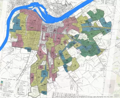
The comic's discussion of contemporary practices soon makes way for an explanation of the historic legacy of housing discrimination. Specifically and clearly, the comic strip tells the story of redlining, which got its start during the Great Depression as a result of the federal government's Home Owners' Loan Corporation.
The conclusion drawn by this clear and colorful example of visualization: racial segregation in American cities didn't happen by accident. "Segregation was systematically created and sustained by federal housing policy."
The comic strip acknowledges its references to a book released in 2017 by historian Richard Rothstein, titled The Color of Law: A Forgotten History of How Our Government Segregated America.
FULL STORY: America’s Shameful History of Housing Discrimination


Racial Disparity in Home Lending Is Today's Redlining
According to a new report detailing discriminatory lending in Chicago, people in majority-white neighborhoods continue to receive more loans, and in greater amounts, than people in majority-Black and majority-Latino areas.

Mapping the Racist History of Real Estate in New Deal America
The Mapping Inequality website documents how the liberal ideals of the New Deal devolved into discrimination and inequality.

Report: Racial Gap in Home Appraisals Increasing
An analysis of government data reveals a growing gap in the appraised values of homes in white and Black neighborhoods.

Maui's Vacation Rental Debate Turns Ugly
Verbal attacks, misinformation campaigns and fistfights plague a high-stakes debate to convert thousands of vacation rentals into long-term housing.

Planetizen Federal Action Tracker
A weekly monitor of how Trump’s orders and actions are impacting planners and planning in America.

San Francisco Suspends Traffic Calming Amidst Record Deaths
Citing “a challenging fiscal landscape,” the city will cease the program on the heels of 42 traffic deaths, including 24 pedestrians.

Defunct Pittsburgh Power Plant to Become Residential Tower
A decommissioned steam heat plant will be redeveloped into almost 100 affordable housing units.

Trump Prompts Restructuring of Transportation Research Board in “Unprecedented Overreach”
The TRB has eliminated more than half of its committees including those focused on climate, equity, and cities.

Amtrak Rolls Out New Orleans to Alabama “Mardi Gras” Train
The new service will operate morning and evening departures between Mobile and New Orleans.
Urban Design for Planners 1: Software Tools
This six-course series explores essential urban design concepts using open source software and equips planners with the tools they need to participate fully in the urban design process.
Planning for Universal Design
Learn the tools for implementing Universal Design in planning regulations.
Heyer Gruel & Associates PA
JM Goldson LLC
Custer County Colorado
City of Camden Redevelopment Agency
City of Astoria
Transportation Research & Education Center (TREC) at Portland State University
Jefferson Parish Government
Camden Redevelopment Agency
City of Claremont