Technology
Hitchhiking as Transportation Solution
With 80 percent of our passenger capacity empty, Jenny O'Brien discusses the potential of hitchhiking apps as a transportation solution in a recent TEDxKC talk.
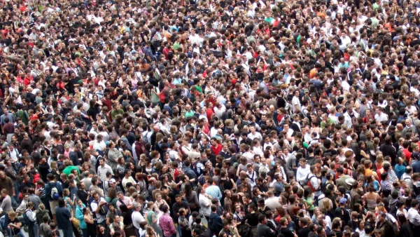
What a Megacity with 107 Million People Looks Like—via SimCity
Writing for Motherboard, Derek Mead details what it took for a particularly ambitious SimCity player to build a city of 100 million people.
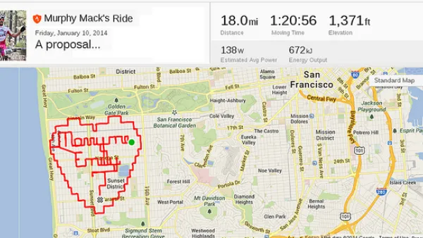
The Power of Public-Private Partnerships: Mobile Phone Apps and Municipalities
Private, crowdsourced mobile phone applications addressing urban mobility collect troves of data on how cities flow. So how can municipalities tap into these databases to accurately understand the movement of their citizens?
Voters in Cleveland to Decide Fate of Automatic Traffic Cameras
In November, voters in Cleveland can decide whether or not to ban the use of automatic traffic cameras to catch red-light violators.
Hacking Traffic Lights with a Laptop
A study by computer scientists from the University of Michigan shows how easy it is to hack and control traffic lights.
Bloomberg Offers $1 Million Annually for 'Innovation Delivery Teams'
Former New York City Mayor Michael Bloomberg began a new program via Bloomberg Philanthropies to invest $45 million for shaking up city halls.
USDOT Announces Proposed Rulemaking for Vehicle-to-Vehicle Communications
USDOT's National Highway Traffic Safety Administration (NHTSA) yesterday publicized an advance notice of proposed rulemaking (ANPRM) and a supporting comprehensive research report on cutting edge V2V communications technology.
Lean Urbanism: A Century-Old Practice?
A short case study in Lean Urbanism, compliments of Victoria Beach, Manitoba.
Sating Food Deserts with Frequent Transit Networks
According to Jarrett Walker, one solution to alleviating food deserts is by providing residents access to frequent transportation networks.
California to Cap Incomes Eligible for Electric Vehicle Rebates
A bill will attempt to bring some equity to the flagrantly inequitable rebate program that subsidizes purchases of Electric Vehicles. Additional subsidies would be directed to low income families. Rebates could also be used for car share and transit.
Ten Years of OpenStreetMap
Exactly how does a student take on an open data political stance and transform it into "the largest crowd-sourced mapping project on the internet"?
Fighting Wildfires with Big Data
WIFIRE, a real-time and data-driven simulation, prediction, and visualization technology, combines satellite and remote sensor data to forecast the potential spread of wildfires.
Mobile App Helps Battle Graffiti in Philadelphia
Philadelphia's Community Life Improvement Program is using Esri's Collector mobile app to empower their data collection in management. Prior to Collector, the anti-graffiti effort was driven by Excel.
The Mapping Tool that Helped Identify the Ebola Outbreak
An online mapping tool called HealthMap helped identify the recent outbreak of the Ebola virus in West Africa by pulling data from all over the big data spectrum. It can also tell provide insight into the health concerns in your area.
Researchers Pull Social Media Data to Track Migration
The limitations (and inaccuracies) of traditional data sources like the U.S. Census are well known, so researchers are looking social media to gather the data necessary to draw conclusions about societal movements.
Study uses Google Street View to Assess Gentrification
By assessing three different groups of indicators, researchers were able to tour thousands of blocks in Chicago through Google Street View and compare visual signs of reinvestment and renewal between 2007 and 2009.
Lyft Line, UberPool: Carpooling Features to Compete with Mass Transit
A new tier of service for Lyft launched today, allowing customers traveling in the same direction to share a ride. The new product follows a similar release earlier this week by Uber.
Floating Vertical Farms Could Deliver and Monitor Food Production in Dense Cities
Known for its density with nearly 20,000 people per square mile, Singapore is changing its food systems strategy to produce more food locally, and reduce food waste.
New Applications for 3D Printing: Sanitation and Shelter
Called by some the "third industrial revolution," what are some of the opportunities and costs of applying 3D printing to issues facing the developing world, and more importantly, emergency housing?
Unlocking the Biogas Potential in America's Farms
Thinking about "renewable power" often bring hydroelectric, wind, and solar to mind. The informed will recognize geothermal and biomass as major renewables. Biogas, the non-fossil natural gas, is not well known because few facilities capture it.

FREE Course: Walkable City 1: Why Walkability?
After describing his path towards focusing on walkability as the essence of good planning, Jeff Speck marches through his five principal reasons for making more walkable places.
Reinventing Malls: Planning Alchemy—Turning Gray Fields Into Gold
The course focuses on the opportunities and imperatives that shape reinvention of mall sites.

City of Rosemead
Rutgers University, Edward J. Bloustein School of Planning and Public Policy
One Hundred Miles
University of Michigan School for Environment and Sustainability (SEAS)
Hunter College, City University of New York (CUNY)
The Architects Foundation
City of Cambridge
Montrose County
The Pocatello Development Authority