


Technology
Top 10 Websites - 2014
Our annual list of the ten best planning, design, and development websites represents only some of the top online resources for news, information and research on the built environment.
When Designers Should Just Say No
The accouterments of modern life are heavily designed, replete with ostensible utility. But here's a radical suggestion: "Perhaps we’re solving the wrong problems — or inventing problems that don’t exist — as justification for our excessive output."
Hybrid Vehicle Sales Take a Dive
A new study revealed that more car buyers are choosing plug-in electric vehicles (PEVs) while fewer are choosing traditional hybrid vehicles. Both types are considered to be electric vehicles, and hybrid sales far outnumber PEV sales.
Chinese City Installs Special Lanes for Distracted Walkers
In both a literal and figurative sign of the times, the Chinese city of Chongqing recently installed signage and marking to segregate pedestrian traffic between smartphone users and those walking free of such technological distractions.
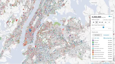
America's Growing Data Divide
The opportunities from data-driven innovations are wide, but many communities experiencing the data divide are without access to or reporting of high-quality data, furthering them from these benefits.
Bus Startup Bridj Hires Gabe Klein as Chief Operations Officer
Gable Klein, former head of transportation for Chicago and Washington D.C., has joined Bridj, a Boston-based startup building dynamically generated bus routes.
Does the Evolution of Smartphones Come at the Expense of 'Spatial Thinking'?
Are smartphones supplementing the capacity of humans to think spatially, such that future generations might lose fundamental cognitive abilities?
Can the 'Sharing Economy Advisory Network' Help Cities and the New Economy Get Along?
The National League of Cities has created the Sharing Economy Advisory Network to develop best practices for cities in developing regulations while also allowing sharing economy businesses to expand and operate.
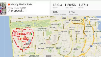
Friday Eye Candy: Social Media and the Beauty of Transit
Jenni Avins shares a collection of videos created on Instagram's new Hyperlapse app that capture the beauty of transportation from every corner of the world.
Breaking News: $5 Billion Tesla Battery 'Gigafactory' Headed to Nevada
With competition from California, Arizona, New Mexico, and Texas, Elon Musk, the CEO of Bay Area-based Tesla Motors, chose the Silver State to build his much sought after $5 billion battery "giga factory."
Hitchhiking as Transportation Solution
With 80 percent of our passenger capacity empty, Jenny O'Brien discusses the potential of hitchhiking apps as a transportation solution in a recent TEDxKC talk.

What a Megacity with 107 Million People Looks Like—via SimCity
Writing for Motherboard, Derek Mead details what it took for a particularly ambitious SimCity player to build a city of 100 million people.
The Power of Public-Private Partnerships: Mobile Phone Apps and Municipalities
Private, crowdsourced mobile phone applications addressing urban mobility collect troves of data on how cities flow. So how can municipalities tap into these databases to accurately understand the movement of their citizens?
Voters in Cleveland to Decide Fate of Automatic Traffic Cameras
In November, voters in Cleveland can decide whether or not to ban the use of automatic traffic cameras to catch red-light violators.
Hacking Traffic Lights with a Laptop
A study by computer scientists from the University of Michigan shows how easy it is to hack and control traffic lights.
Bloomberg Offers $1 Million Annually for 'Innovation Delivery Teams'
Former New York City Mayor Michael Bloomberg began a new program via Bloomberg Philanthropies to invest $45 million for shaking up city halls.
USDOT Announces Proposed Rulemaking for Vehicle-to-Vehicle Communications
USDOT's National Highway Traffic Safety Administration (NHTSA) yesterday publicized an advance notice of proposed rulemaking (ANPRM) and a supporting comprehensive research report on cutting edge V2V communications technology.
Lean Urbanism: A Century-Old Practice?
A short case study in Lean Urbanism, compliments of Victoria Beach, Manitoba.
Sating Food Deserts with Frequent Transit Networks
According to Jarrett Walker, one solution to alleviating food deserts is by providing residents access to frequent transportation networks.
California to Cap Incomes Eligible for Electric Vehicle Rebates
A bill will attempt to bring some equity to the flagrantly inequitable rebate program that subsidizes purchases of Electric Vehicles. Additional subsidies would be directed to low income families. Rebates could also be used for car share and transit.
Urban Design for Planners 1: Software Tools
This six-course series explores essential urban design concepts using open source software and equips planners with the tools they need to participate fully in the urban design process.
Planning for Universal Design
Learn the tools for implementing Universal Design in planning regulations.
Heyer Gruel & Associates PA
JM Goldson LLC
Custer County Colorado
City of Camden Redevelopment Agency
City of Astoria
Transportation Research & Education Center (TREC) at Portland State University
Camden Redevelopment Agency
City of Claremont
Municipality of Princeton (NJ)


