


The first comprehensive manual for planning, funding, and building a freeway cap is put online for review and comment.
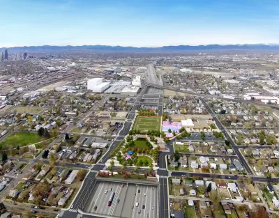
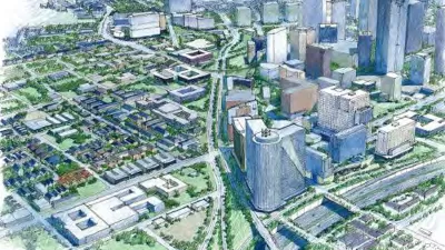
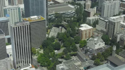
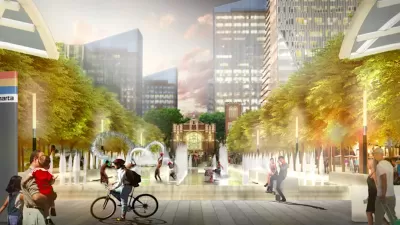
Nearly every major city is contemplating reconnecting neighborhoods divided by a highway built under The Federal Highway Act. Many cities already have one or more parks or civic buildings built over FHWA funded highways. Some of the more notable projects include the Rose Kennedy Fitzgerald Kennedy Greenway (Boston aka “The Big Dig”), the Klyde Warren Park (Dallas), Bartle Hall Convention Center (Kansas City), and Freeway Park (Seattle). However, as cities are again popular places to live, there has been even greater interest in covering the highways that divide and pollute urban neighborhoods. Many of these highways were built in trenches that evoke visions of covering them with parks, civic buildings, or even private development.
Freeway benefits to the surrounding communities include:
- Increased property values
- Increased density and housing
- Increased retail sales
- Increased hotel development and occupancy
- Increased area jobs
- Increased property tax, payroll tax, hotel tax, and sales tax revenue
- Improved park and recreational opportunities
- Improved air quality
However, there is little documentation on how to accomplish these large and daunting projects. This is the circumstance confronting participants of local movements to build over a highway or freeway, and this was the circumstance encountered by the author of a draft book on the subject as he participated in a San Diego movement to reconnect the city’s urban park (Balboa Park) and urban neighborhoods with downtown over Interstate 5. He decided to document what he learned in a guide book. He has put his first draft online to share what he has learned and to source additional information from those who might have useful information to contribute to the effort.
FULL STORY: Book: How to Build a Freeway Cap

Reimagining the Urban Freeway
With the new administration placing racial justice and equity at the forefront of transportation policy, will America finally reckon with the legacy of its freeways?
I-5 Study Shows Benefits of Capping Urban Freeways
Putting a lid on the interstate through downtown Seattle could create new space for parks and housing, reduce pollution, and reconnect the disrupted street grid.
Atlanta Launches Website for Highway Cap Project
Residents can view plans for the 14-acre project that include public plazas and green spaces connecting local landmarks, employment centers, and transit stations.

Planetizen Federal Action Tracker
A weekly monitor of how Trump’s orders and actions are impacting planners and planning in America.

San Francisco's School District Spent $105M To Build Affordable Housing for Teachers — And That's Just the Beginning
SFUSD joins a growing list of school districts using their land holdings to address housing affordability challenges faced by their own employees.

The Tiny, Adorable $7,000 Car Turning Japan Onto EVs
The single seat Mibot charges from a regular plug as quickly as an iPad, and is about half the price of an average EV.

Seattle's Plan for Adopting Driverless Cars
Equity, safety, accessibility and affordability are front of mind as the city prepares for robotaxis and other autonomous vehicles.

As Trump Phases Out FEMA, Is It Time to Flee the Floodplains?
With less federal funding available for disaster relief efforts, the need to relocate at-risk communities is more urgent than ever.

With Protected Lanes, 460% More People Commute by Bike
For those needing more ammo, more data proving what we already knew is here.
Urban Design for Planners 1: Software Tools
This six-course series explores essential urban design concepts using open source software and equips planners with the tools they need to participate fully in the urban design process.
Planning for Universal Design
Learn the tools for implementing Universal Design in planning regulations.
Smith Gee Studio
City of Charlotte
City of Camden Redevelopment Agency
City of Astoria
Transportation Research & Education Center (TREC) at Portland State University
US High Speed Rail Association
City of Camden Redevelopment Agency
Municipality of Princeton (NJ)