


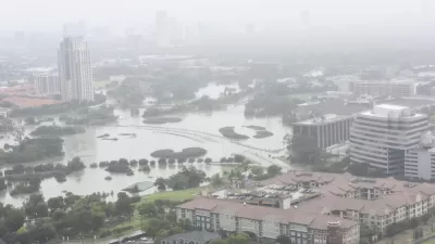
The city of Houston approved a new development that doesn't meet new elevations standards approved by the city of Houston earlier this month.

"Mayor Sylvester Turner and City Council, unanimously and without discussion, approved a developer’s plan to build hundreds of homes in a west Houston flood plain Wednesday," reports Mike Morris.
The approval enables the creation of a municipal utility district that can issue bonds to fund the construction of road, water, sewer, and stormwater infrastructure. Meritage Homes and MetroNational is planning to build 800 homes on the former site of Pine Crest Golf Course.
The companies behind the project say they will take steps to lesson flooding risk, but nearby residents are skeptical and even the city's own rules would seem to prevent the development from moving forward.
Meritage Homes is regrading the site, digging three detention ponds and a new channel to guide water through the site and into Brickhouse Gully. The excavated dirt will be piled elsewhere on the site and the new homes will sit on top of that soil, Meritage officials have said, with the lowest structure sitting 2.78 feet above the projected water level in a 500-year flood.
That would exceed the new elevation standard — two feet above the 500-year flood level — that council adopted for development in floodplains earlier this month.
FULL STORY: City Council unanimously backs plan to build homes in floodplain

Houston Seriously Tightens Rules on Floodplain Construction
It was the city's "first major regulatory response" to Hurricane Harvey.
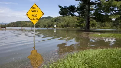
Houston-Area Floodplain Regulations to Expand from 100-Year to 500-Year Levels
Harris County, home to Houston and the scene of widespread devastation during Hurricane Harvey and other weather events, will make large-scale changes to development regulations on floodplains for the first time in almost 20 years.

Harris County Will Use Toll Road Revenue to Pay for Flood Control
A new Flood Resilience Trust will create a permanent source of funding for flood control purposes, but the county still faces a shortfall for planned projects.

Planetizen Federal Action Tracker
A weekly monitor of how Trump’s orders and actions are impacting planners and planning in America.

Restaurant Patios Were a Pandemic Win — Why Were They so Hard to Keep?
Social distancing requirements and changes in travel patterns prompted cities to pilot new uses for street and sidewalk space. Then it got complicated.

Map: Where Senate Republicans Want to Sell Your Public Lands
For public land advocates, the Senate Republicans’ proposal to sell millions of acres of public land in the West is “the biggest fight of their careers.”

Maui's Vacation Rental Debate Turns Ugly
Verbal attacks, misinformation campaigns and fistfights plague a high-stakes debate to convert thousands of vacation rentals into long-term housing.

San Francisco Suspends Traffic Calming Amidst Record Deaths
Citing “a challenging fiscal landscape,” the city will cease the program on the heels of 42 traffic deaths, including 24 pedestrians.

California Homeless Arrests, Citations Spike After Ruling
An investigation reveals that anti-homeless actions increased up to 500% after Grants Pass v. Johnson — even in cities claiming no policy change.
Urban Design for Planners 1: Software Tools
This six-course series explores essential urban design concepts using open source software and equips planners with the tools they need to participate fully in the urban design process.
Planning for Universal Design
Learn the tools for implementing Universal Design in planning regulations.
Heyer Gruel & Associates PA
JM Goldson LLC
Custer County Colorado
City of Camden Redevelopment Agency
City of Astoria
Transportation Research & Education Center (TREC) at Portland State University
Camden Redevelopment Agency
City of Claremont
Municipality of Princeton (NJ)