


The Regional Plan Association calls on the power of the contemporary Internet to broadcast stories of displacement from around Greater New York.

The Regional Plan Association (RPA) has published an interactive, multi-media map to supplement its report "Pushed Out: Displacement in an Unaffordable Region" [pdf].
The interactive map illustrates the RPA's "Displacement Index," which locates Census tracts at risk and Census tracts at risk with a shifting market. Another layer allows testimonials from residents affected by displacement. So, for instance, Ray from East Harlem can describe in his own words his experience as the "Last Tenant Standing" in his apartment building.
The "Pushed Out" report was released in March 2017, but the map is helping promote the report in connection with this week's #RenterWeekofAction.
FULL STORY: Pushed Out Voices From Around the Region


Regional Plan Association Recommends Closing One Airport, Expanding Others Near New York
The total cost of the recommendations from a new report on the future of air travel in the New York region: $50.8 billion over 40 years.

The Fourth Regional Plan Plots a Course for the New York Region
The Regional Plan Association released its eagerly anticipated Fourth Regional Plan on Thursday.
Study: New York Suburbs Need to Zone for Higher Density Transit Oriented Development
The Regional Plan Association released a new study that recommends steps toward higher density transit oriented development in transit adjacent communities around the New York region. The study also teases a big release coming later this month.

Maui's Vacation Rental Debate Turns Ugly
Verbal attacks, misinformation campaigns and fistfights plague a high-stakes debate to convert thousands of vacation rentals into long-term housing.

Planetizen Federal Action Tracker
A weekly monitor of how Trump’s orders and actions are impacting planners and planning in America.

San Francisco Suspends Traffic Calming Amidst Record Deaths
Citing “a challenging fiscal landscape,” the city will cease the program on the heels of 42 traffic deaths, including 24 pedestrians.

Defunct Pittsburgh Power Plant to Become Residential Tower
A decommissioned steam heat plant will be redeveloped into almost 100 affordable housing units.

Trump Prompts Restructuring of Transportation Research Board in “Unprecedented Overreach”
The TRB has eliminated more than half of its committees including those focused on climate, equity, and cities.

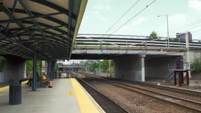
Amtrak Rolls Out New Orleans to Alabama “Mardi Gras” Train
The new service will operate morning and evening departures between Mobile and New Orleans.
Urban Design for Planners 1: Software Tools
This six-course series explores essential urban design concepts using open source software and equips planners with the tools they need to participate fully in the urban design process.
Planning for Universal Design
Learn the tools for implementing Universal Design in planning regulations.
Heyer Gruel & Associates PA
JM Goldson LLC
Custer County Colorado
City of Camden Redevelopment Agency
City of Astoria
Transportation Research & Education Center (TREC) at Portland State University
Jefferson Parish Government
Camden Redevelopment Agency
City of Claremont