


The variables in public transit service have never been so brightly and kinetically illustrated.
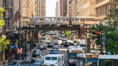
Will Geary explains the thinking behind, TransitFlow, "an experimental set of tools to generate spatial-temporal transit frequency datasets and visualizations from the command line."
That is, TransitFlow allows the creation of animated maps showing the movement of public transit modes around cities and regions. The TransitFlow team created the tool to help illustrate the importance of frequency, among other critical aspects of transit service.
See below for examples of the San Francisco Bay Area, New York City, Amtrak trips around the United States, and Mexico City.
There are a lot more examples from around the United States and the world available on Geary's Vimeo portfolio.
FULL STORY: TransitFlow — using Python and Processing to visualize regional transit frequency


A New Way to Explore Local Transit Ridership Data
TransitCenter has released a new National Ridership Map.
Mapping Climate Impact at the Neighborhood Level
A consumption-based analysis illustrates the differences in average household emissions across census tracts.
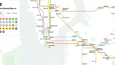
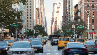
The New New York Subway Map Works in Real Time
There's a new chapter, and maybe an end, for the "Great Subway Map Debate."

Planetizen Federal Action Tracker
A weekly monitor of how Trump’s orders and actions are impacting planners and planning in America.

Congressman Proposes Bill to Rename DC Metro “Trump Train”
The Make Autorail Great Again Act would withhold federal funding to the system until the Washington Metropolitan Area Transit Authority (WMATA), rebrands as the Washington Metropolitan Authority for Greater Access (WMAGA).

DARTSpace Platform Streamlines Dallas TOD Application Process
The Dallas transit agency hopes a shorter permitting timeline will boost transit-oriented development around rail stations.

Renters Now Outnumber Homeowners in Over 200 US Suburbs
High housing costs in city centers and the new-found flexibility offered by remote work are pushing more renters to suburban areas.

The Tiny, Adorable $7,000 Car Turning Japan Onto EVs
The single seat Mibot charges from a regular plug as quickly as an iPad, and is about half the price of an average EV.

Supreme Court Ruling in Pipeline Case Guts Federal Environmental Law
The decision limits the scope of a federal law that mandates extensive environmental impact reviews of energy, infrastructure, and transportation projects.
Urban Design for Planners 1: Software Tools
This six-course series explores essential urban design concepts using open source software and equips planners with the tools they need to participate fully in the urban design process.
Planning for Universal Design
Learn the tools for implementing Universal Design in planning regulations.
Municipality of Princeton
Roanoke Valley-Alleghany Regional Commission
City of Mt Shasta
City of Camden Redevelopment Agency
City of Astoria
Transportation Research & Education Center (TREC) at Portland State University
US High Speed Rail Association
City of Camden Redevelopment Agency
Municipality of Princeton (NJ)