


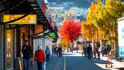
The city of Seattle provides the geography and market for a housing map that illustrates the differences between single-family and multi-family housing in terms of affordability.

Margaret Morales writes the text to accompany an ambitious new mapping project by the Sightline Institute. In the article, Morales introduces the story of a rental home comprising two units in Ballard, a neighborhood in Seattle, which was recently redeveloped into four rowhouses.
Where one home once stood, now there are 4. The homes in the new rowhouses are each, at 1,160 square feet, almost as big as the old house’s two units combined, which totaled 1,360 square feet. The rowhouses have two bedrooms and 1.5 bathrooms each. And, of course, they’re new, not a century old. They have dramatically improved insulation, wiring, plumbing, and safety features. They each sold in 2016 for more than $530,000, for a total of $2.3 million. That’s more than four and a half times the 2014 sale price of the old house, but of course, building them cost a lot, too.
Morales acknowledges that the story sounds like one of loss, and a developer getting rich while moving the city's housing stock further out of reach for most of the city's residents. But, Sightline also sees another side to the story—if the lot had been zoned for single-family zoning the blow to the city's affordability might have been worse.
To scale-up the implications of this story from Ballard, the Sightline team created a map in answer to the question: "Do multi-family homes, like the rowhouses in Devin’s story, or things like condominiums, townhomes, and the four-packs popping up across the city, offer Seattleites cheaper or more expensive housing options than single-family homes?"
The conclusion Morales gleans from the map: "Multi-family homes are offering Seattleites cheaper homeownership alternatives to single-family homes."
FULL STORY: MAP: WHERE MULTI-FAMILY HOMES MAKE SEATTLE NEIGHBORHOODS MORE AFFORDABLE

Zoning Reform: Lessons From New Zealand
The island nation is mandating mid-density zoning requirements and transit-oriented development in an effort to increase housing affordability and encourage compact development.
Survey: Seattle-Area Residents Support Upzoning
To fight the growing housing crisis, most King County residents support an end to single-family zoning and accelerated housing development, according to a new poll.

High Housing Costs Driving Down Transit Ridership in LA
When neighborhoods gentrify and displace lower-income residents, transit ridership suffers, new research shows.

Planetizen Federal Action Tracker
A weekly monitor of how Trump’s orders and actions are impacting planners and planning in America.

Map: Where Senate Republicans Want to Sell Your Public Lands
For public land advocates, the Senate Republicans’ proposal to sell millions of acres of public land in the West is “the biggest fight of their careers.”

Restaurant Patios Were a Pandemic Win — Why Were They so Hard to Keep?
Social distancing requirements and changes in travel patterns prompted cities to pilot new uses for street and sidewalk space. Then it got complicated.

Platform Pilsner: Vancouver Transit Agency Releases... a Beer?
TransLink will receive a portion of every sale of the four-pack.

Toronto Weighs Cheaper Transit, Parking Hikes for Major Events
Special event rates would take effect during large festivals, sports games and concerts to ‘discourage driving, manage congestion and free up space for transit.”

Berlin to Consider Car-Free Zone Larger Than Manhattan
The area bound by the 22-mile Ringbahn would still allow 12 uses of a private automobile per year per person, and several other exemptions.
Urban Design for Planners 1: Software Tools
This six-course series explores essential urban design concepts using open source software and equips planners with the tools they need to participate fully in the urban design process.
Planning for Universal Design
Learn the tools for implementing Universal Design in planning regulations.
Heyer Gruel & Associates PA
JM Goldson LLC
Custer County Colorado
City of Camden Redevelopment Agency
City of Astoria
Transportation Research & Education Center (TREC) at Portland State University
Camden Redevelopment Agency
City of Claremont
Municipality of Princeton (NJ)