


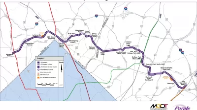
The U.S. Department of Transportation and the state of Maryland are expected to sign a funding agreement next week for the Purple Line between Montgomery and Prince George's counties.

Robert McCartney and Faiz Siddiqui report: "Maryland’s Purple Line will receive a $900 million federal full funding agreement from the Trump administration, officials said Monday, a critical step forward for the oft-delayed project."
"Construction of the 16-mile light-rail line linking Montgomery and Prince George’s counties will begin within weeks after the deal is formalized," add McCartney and Siddiqui.
The decision to fund the project comes only a few months after a court decision seemed to have doomed the project to the dustbin of history, but the "announcement put to rest worries in Maryland that the Purple Line might fall victim to desires in the Trump administration and the Republican Party to trim federal transit spending."
As noted in the article, however, if the Trump Administration gets its way, this transit project could be the last to have a happy ending, because the "White House budget released in the spring proposed eliminating new federal grants for transit construction, and the GOP party platform urged phasing out all federal transit spending."
FULL STORY: Maryland to get $900-million federal full funding agreement for Purple Line

Maryland's Purple Line Gets the Green Light Again
The public-private partnership behind the Purple Line light rail project in Maryland fell apart in September, and has this past week been revived.
Purple Line Construction Halts in Maryland as Contractor Woes Deepen
Purple Line Transit Partners, the contractors managing construction of the beleaguered Purple Line in Maryland, have begun to walk off the job as a dispute about cost overruns brings the project to a screeching halt.
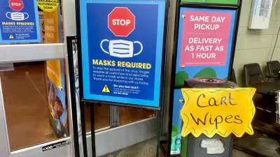
Biden: Masks, Not Vaccines, Are Best Defense in Near Term
President Joe Biden is calling on all Americans to wear masks for the next 100 days to mitigate the spread of the coronavirus, issuing two executive orders that require wearing masks on federal property and in domestic and international travel.

Montreal Mall to Become 6,000 Housing Units
Place Versailles will be transformed into a mixed-use complex over the next 25 years.

Planetizen Federal Action Tracker
A weekly monitor of how Trump’s orders and actions are impacting planners and planning in America.

DARTSpace Platform Streamlines Dallas TOD Application Process
The Dallas transit agency hopes a shorter permitting timeline will boost transit-oriented development around rail stations.

Study: 4% of Truckers Lack a Valid Commercial License
Over 56% of inspected trucks had other violations.

Chicago Judge Orders Thousands of Accessible Ped Signals
Only 3% of the city's crossing signals are currently accessible to blind pedestrians.

Philadelphia Swaps Car Lanes for Bikeways in Unanimous Vote
The project will transform one of the handful of streets responsible for 80% of the city’s major crashes.
Urban Design for Planners 1: Software Tools
This six-course series explores essential urban design concepts using open source software and equips planners with the tools they need to participate fully in the urban design process.
Planning for Universal Design
Learn the tools for implementing Universal Design in planning regulations.
City of Mt Shasta
City of Camden Redevelopment Agency
City of Astoria
Transportation Research & Education Center (TREC) at Portland State University
US High Speed Rail Association
City of Camden Redevelopment Agency
Municipality of Princeton (NJ)