


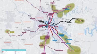
A 25-year regional transit plan, which includes five corridors for light rail or bus rapid transit lines, is taking shape in Nashville,
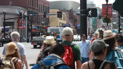
"As Mayor Megan Barry's administration pursues the first spoke of a light rail system in Nashville, a new report shows how the entire five-corridor network could work, what it might look like, and where Metro faces construction and right-of-way challenges," reports Joey Garrison.
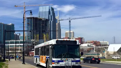
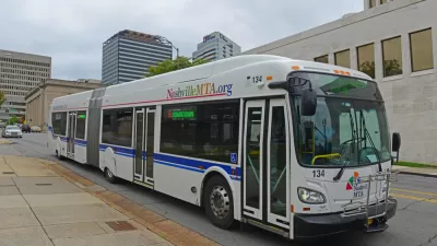
The Nashville Metro Transit Authority recently released a "High Capacity Transit Briefing Book" [pdf] to map out the prospective system. "The report's release completes the final phase of the region's nMotion transit plan, which outlines a proposed $6 billion transit system for Middle Tennessee over the next 25 years," adds Garrison.
Planetizen covered the nMotion plan on several occasions after the plan's initial release in August 2016, approval in September 2016, and initial funding inquiries in November 2016. Currently, Mayor Barry is pitching the idea of a referendum in May to "let voters decide whether to dedicate new tax revenue to pay for transit projects."
The article includes more details on the routes and modes targeted in the plan.

FULL STORY: How light rail on Nashville corridors could work — and where the challenges are

Nashville Could Be a National Example for Transit—If They Don't Screw Up
Nashville Mayor Megan Barry resigned from office earlier this month. The question now becomes whether an ambitious transit investment plan she supported can survive her exit.
A New Transit Hub Pitched in Nashville
The city of Nashville is trying to get back on track with some of the projects proposed in the 2016 nMotion plan—even without the massive pot of transit tax money it could have won at the ballot box.
Mayor Throws Support Behind Nashville's $5.2 Billion Transit Plan
The speculation about a planned transit investment program in Nashville began in August, and now the mayor is throwing full support behind a referendum that would raise four kinds of taxes to pay for a $5.2 billion in transit investments.

Planetizen Federal Action Tracker
A weekly monitor of how Trump’s orders and actions are impacting planners and planning in America.

Chicago’s Ghost Rails
Just beneath the surface of the modern city lie the remnants of its expansive early 20th-century streetcar system.

San Antonio and Austin are Fusing Into one Massive Megaregion
The region spanning the two central Texas cities is growing fast, posing challenges for local infrastructure and water supplies.

Since Zion's Shuttles Went Electric “The Smog is Gone”
Visitors to Zion National Park can enjoy the canyon via the nation’s first fully electric park shuttle system.

Trump Distributing DOT Safety Funds at 1/10 Rate of Biden
Funds for Safe Streets and other transportation safety and equity programs are being held up by administrative reviews and conflicts with the Trump administration’s priorities.

German Cities Subsidize Taxis for Women Amid Wave of Violence
Free or low-cost taxi rides can help women navigate cities more safely, but critics say the programs don't address the root causes of violence against women.
Urban Design for Planners 1: Software Tools
This six-course series explores essential urban design concepts using open source software and equips planners with the tools they need to participate fully in the urban design process.
Planning for Universal Design
Learn the tools for implementing Universal Design in planning regulations.
planning NEXT
Appalachian Highlands Housing Partners
Mpact (founded as Rail~Volution)
City of Camden Redevelopment Agency
City of Astoria
City of Portland
City of Laramie