


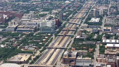
UIC architecture students competed to design improvements for the spaces under Chicago's South Side "Skyway," which carries drivers from the city to and from Northwest Indiana.
Underpasses on Chicago's South Side were the subject of a University of Illinois at Chicago contest for architecture students. Chicago's Skyway is a privately owned highway that connects northwest Indiana and Chicago. The South Chicago Chamber of Commerce and architecture firm, Urban Labs, put together an exhibition of the student's concepts.
"The purpose of last week’s meeting was to gather feedback from the community on what they would like to see occupy the 93rd and Commercial space," Maribel Quezada writes for Streetsblog Chicago.
In many of the proposals, little-loved spaces would turn into places to walk, bike or relax, enlivening the neighborhood the Skyway passes through on the southeast side of Chicago. "Under this proposal, the space would be transformed into a unique, recognizable public space that would attract and benefit multiple generations through the use of art, a garden-market, and play spaces," Quezada writes.
FULL STORY: South Chicagoans Weigh in on Plans to Activate Dead Space Under the Skyway

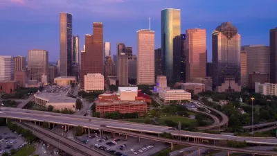
Reimagining the Space Beneath Houston’s Freeways
Opportunities abound for Houston to capitalize on otherwise unused space beneath its wide network of freeways.
Chicago Awarded $2M Reconnecting Communities Grant
Community advocates say the city’s plan may not do enough to reverse the negative impacts of a major expressway.
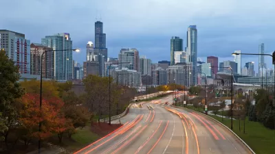
Chicago's Lake Shore Drive Renamed to Honor Black Pioneer
Introducing Jean Baptiste Point DuSable Lake Shore Drive, renamed to honor the first non-indigenous settler of Chicago.

Planetizen Federal Action Tracker
A weekly monitor of how Trump’s orders and actions are impacting planners and planning in America.

Restaurant Patios Were a Pandemic Win — Why Were They so Hard to Keep?
Social distancing requirements and changes in travel patterns prompted cities to pilot new uses for street and sidewalk space. Then it got complicated.

Map: Where Senate Republicans Want to Sell Your Public Lands
For public land advocates, the Senate Republicans’ proposal to sell millions of acres of public land in the West is “the biggest fight of their careers.”

Maui's Vacation Rental Debate Turns Ugly
Verbal attacks, misinformation campaigns and fistfights plague a high-stakes debate to convert thousands of vacation rentals into long-term housing.

San Francisco Suspends Traffic Calming Amidst Record Deaths
Citing “a challenging fiscal landscape,” the city will cease the program on the heels of 42 traffic deaths, including 24 pedestrians.

California Homeless Arrests, Citations Spike After Ruling
An investigation reveals that anti-homeless actions increased up to 500% after Grants Pass v. Johnson — even in cities claiming no policy change.
Urban Design for Planners 1: Software Tools
This six-course series explores essential urban design concepts using open source software and equips planners with the tools they need to participate fully in the urban design process.
Planning for Universal Design
Learn the tools for implementing Universal Design in planning regulations.
Heyer Gruel & Associates PA
JM Goldson LLC
Custer County Colorado
City of Camden Redevelopment Agency
City of Astoria
Transportation Research & Education Center (TREC) at Portland State University
Camden Redevelopment Agency
City of Claremont
Municipality of Princeton (NJ)