


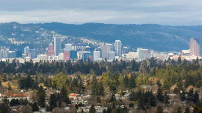
A growing Portland has seen many arguments about how to accommodate an influx of residents—recommends the "step back" as a way to add density without adding shadows or creating wind tunnels.
The top of a building can have big impacts on shadows, wind passage, and views. Too often, Portland buildings are just blocks, argues Michael Mehaffy in a piece for Livable Portland. A preferable option would be to build "step backs" (step-like recessions at the tops of buildings) as a way to resolve some of the conflicts between the YIMBY crowd and those concerned about development in the city.
Why don't developers build more step back projects? "Profit-minded developers usually make more money when they go straight up from the street," Mehaffy argues. "But going straight up is precisely what a generation of failed “modernist” projects did in the 1960s, with very unhappy results," he goes on to say. Those who say they're concerned about the look of a project or its potential shadows might not be easily satisfied with this compromise, still the step back seems to be a good option for those that seek to build coalitions and…buildings.
FULL STORY: Is it time for Portland to rediscover the “step-back”?


Portland Approves ‘Residential Infill Project – Part 2' to Add New Forms of Residential Density
The city of Portland is already building upon the historic work of the Residential Infill Project, approved by the city in August 2021, with a new slate of zoning changes dubbed the ‘Residential Infill Project – Part 2.”
The 'Most Pro-Housing Reform in U.S. History' Expected for Approval Today in Portland
The Portland Residential Infill Project is expected for approval by the Portland City Council today, culminating a six year process that became more and more ambitious with every iteration.

Portland Adjusts Residential Infill Plan to Minimize Displacement
Portland wants to add density but doesn't want to displace current residents of low- and middle-income neighborhoods.

Planetizen Federal Action Tracker
A weekly monitor of how Trump’s orders and actions are impacting planners and planning in America.

Map: Where Senate Republicans Want to Sell Your Public Lands
For public land advocates, the Senate Republicans’ proposal to sell millions of acres of public land in the West is “the biggest fight of their careers.”

Restaurant Patios Were a Pandemic Win — Why Were They so Hard to Keep?
Social distancing requirements and changes in travel patterns prompted cities to pilot new uses for street and sidewalk space. Then it got complicated.

Platform Pilsner: Vancouver Transit Agency Releases... a Beer?
TransLink will receive a portion of every sale of the four-pack.

Toronto Weighs Cheaper Transit, Parking Hikes for Major Events
Special event rates would take effect during large festivals, sports games and concerts to ‘discourage driving, manage congestion and free up space for transit.”

Berlin to Consider Car-Free Zone Larger Than Manhattan
The area bound by the 22-mile Ringbahn would still allow 12 uses of a private automobile per year per person, and several other exemptions.
Urban Design for Planners 1: Software Tools
This six-course series explores essential urban design concepts using open source software and equips planners with the tools they need to participate fully in the urban design process.
Planning for Universal Design
Learn the tools for implementing Universal Design in planning regulations.
Heyer Gruel & Associates PA
JM Goldson LLC
Custer County Colorado
City of Camden Redevelopment Agency
City of Astoria
Transportation Research & Education Center (TREC) at Portland State University
Camden Redevelopment Agency
City of Claremont
Municipality of Princeton (NJ)