


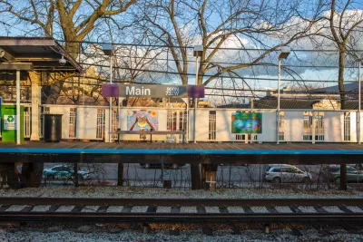
No cities are entirely urban, or even similar from one neighborhood to the next. The Corner Side Yard has some fun thinking about which Chicago neighborhoods we "Chicago in Name Only" and which of its suburbs are "Suburbs in Name Only."
Pete Saunders opens a discussion about how sometimes neighborhoods in cities feel and act more suburban than the suburbs located outside the city.
The discussion began with an earlier article about the neighborhood of Mount Greenwood, located in the city of Chicago. Mount Greenwood is defined by physical characteristics that create a different kind of city neighborhood, according to Saunders, which limits the investment potential of the neighborhood and leaves the neighborhood relatively unaffected by the winds of market change.
Where the discussion branches off, is in a response to the article from a reader named John Carlisle. In a message shared by Saunders, Carlisle posits the idea of "CHI-NOs" (Chicago in Name Only) and "SINOs" (Suburb in Name Only). Carlisle has ideas about which neighborhoods in Chicago fit each description, and lists them accordingly.
While Saunders admits there isn't any serious scientific analysis involved in creating the CHI-NO or SINO taxonomy, they do effectively "point out that the city-suburb chasm in terms of lifestyle is a lot more fluid than many would like to believe."
FULL STORY: Cities and Suburbs -- In Name Only

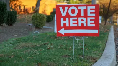
The Crucial Role of Suburban Voters in the Midterms
Suburban voters were instrumental in preventing a 'red wave' on Election Day and on December 6 in the Georgia U.S. Senate runoff election, enabling the Democrats to win a 51st Senate seat.
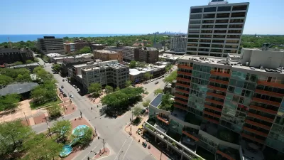
Chicago Suburbs Luring Back Major Employers
As more workers move away from the central city due to high costs and remote work opportunities, companies that once relocated downtown are eyeing Chicago’s suburbs once again.
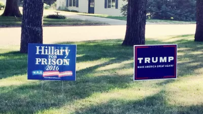
How Trump's Version of the Suburbs Gets it Wrong
Analysis of Trump's favorability ratings with suburban voters and the demographic trends of recent years could doom his recent messages regarding the Democratic agenda for the suburbs.

Planetizen Federal Action Tracker
A weekly monitor of how Trump’s orders and actions are impacting planners and planning in America.

Congressman Proposes Bill to Rename DC Metro “Trump Train”
The Make Autorail Great Again Act would withhold federal funding to the system until the Washington Metropolitan Area Transit Authority (WMATA), rebrands as the Washington Metropolitan Authority for Greater Access (WMAGA).

DARTSpace Platform Streamlines Dallas TOD Application Process
The Dallas transit agency hopes a shorter permitting timeline will boost transit-oriented development around rail stations.

Renters Now Outnumber Homeowners in Over 200 US Suburbs
High housing costs in city centers and the new-found flexibility offered by remote work are pushing more renters to suburban areas.

The Tiny, Adorable $7,000 Car Turning Japan Onto EVs
The single seat Mibot charges from a regular plug as quickly as an iPad, and is about half the price of an average EV.

Supreme Court Ruling in Pipeline Case Guts Federal Environmental Law
The decision limits the scope of a federal law that mandates extensive environmental impact reviews of energy, infrastructure, and transportation projects.
Urban Design for Planners 1: Software Tools
This six-course series explores essential urban design concepts using open source software and equips planners with the tools they need to participate fully in the urban design process.
Planning for Universal Design
Learn the tools for implementing Universal Design in planning regulations.
Municipality of Princeton
Roanoke Valley-Alleghany Regional Commission
City of Mt Shasta
City of Camden Redevelopment Agency
City of Astoria
Transportation Research & Education Center (TREC) at Portland State University
US High Speed Rail Association
City of Camden Redevelopment Agency
Municipality of Princeton (NJ)