


The San Francisco Chronicle gives feature-length, in-depth treatment to the looming dangers of sea level rise, which are more likely to encroach on the built and natural environments of the Bay Area with every passing year.
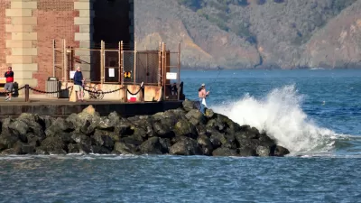
John King writes of a profound challenge facing the San Francisco Bay Area: "to accommodate the bay’s impending expansion as it rises because of our warming planet."
An abundance of scientific studies says the bay’s average tide could climb several feet or more by 2100, with most change coming in the decades after 2050. It’s an inexorable shift that threatens low-lying neighborhoods as well as the fish, birds and wildlife that need tidal flats to survive.
After an aperture that tends toward the dire, King sounds a note of optimism: the Bay Area is presented with a window of time to prepare for the effects of climate change. Moreover, there are already success stories that exemplify the larger project facing the Bay Area. A concern emerging from those success stories, however, is how many years of planning, review, and construction required to deliver their benefits. To create the additional wetlands necessary to "absorb the worst impacts of sea-level rise later this century," according to King, "the Bay Area must overcome a protective mind-set that values time-consuming review processes above all else."
The political work King prescribes will have to take place at the Bay Conservation and Development Commission, created in 1965 for a different era of environmental and conservation concerns. The commission has taken steps, as recently as May of this year, but King notes how that effort still falls short of changing existing regulations.
The article is a long read, with a whole package of infographics, beautiful photography, and videos. The San Francisco Chronicle promises more coverage from King on the challenges of sea level rise, including the perils facing the city’s crumbling Embarcadero, the potential rebirth of the South Bay’s salt marshes and the creation of a small city on man-made Treasure Island. If the first article is any indicator, expect more thoughtful dialogue between the necessary steps to prepare the Bay Area for sea level rise and the forces that must be overcome, some human and some environmental, in the process.
FULL STORY: Rising reality


Bay Area Developments at Risk From Sea Level Rise
A controversial proposed housing development in Newark exemplifies the struggle between increasing housing supply and protecting vulnerable shoreline communities from flooding.
Bay Area's First Climate Adaptation Project Could Be a North Bay Highway
State Route 37 is a vital highway connecting four North Bay counties plagued by two unrelated problems: chronic flooding during high tides and traffic congestion. Fixing the problem will set a precedent for Bay Area climate adaptation.

Opinion: One Solution to Manhattan's Land Shortage: Just Build It
A New York Times op-ed calls on the city to add landfill development on Manhattan's southern shoreline, claiming it would increase affordability and protect the city from rising sea levels.

Maui's Vacation Rental Debate Turns Ugly
Verbal attacks, misinformation campaigns and fistfights plague a high-stakes debate to convert thousands of vacation rentals into long-term housing.

Planetizen Federal Action Tracker
A weekly monitor of how Trump’s orders and actions are impacting planners and planning in America.

Chicago’s Ghost Rails
Just beneath the surface of the modern city lie the remnants of its expansive early 20th-century streetcar system.

Bend, Oregon Zoning Reforms Prioritize Small-Scale Housing
The city altered its zoning code to allow multi-family housing and eliminated parking mandates citywide.

Amtrak Cutting Jobs, Funding to High-Speed Rail
The agency plans to cut 10 percent of its workforce and has confirmed it will not fund new high-speed rail projects.

LA Denies Basic Services to Unhoused Residents
The city has repeatedly failed to respond to requests for trash pickup at encampment sites, and eliminated a program that provided mobile showers and toilets.
Urban Design for Planners 1: Software Tools
This six-course series explores essential urban design concepts using open source software and equips planners with the tools they need to participate fully in the urban design process.
Planning for Universal Design
Learn the tools for implementing Universal Design in planning regulations.
planning NEXT
Appalachian Highlands Housing Partners
Mpact (founded as Rail~Volution)
City of Camden Redevelopment Agency
City of Astoria
City of Portland
City of Laramie