


A controversial proposed housing development in Newark exemplifies the struggle between increasing housing supply and protecting vulnerable shoreline communities from flooding.
(NRCS_Photo_Gallery).jpg)
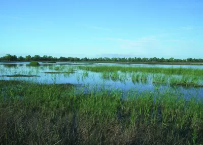
Although sea levels could rise by at least a foot in the next decade, reports Ezra David Romero, a developer is planning to go ahead with a controversial housing development on the shores of San Francisco Bay.
The project, which would build 469 badly needed housing units in Newark, would be located in a federal flood zone just outside the jurisdiction of the Bay Conservation and Development Commission. Despite the developer's plan to "drive in around 100,000 truckloads of dirt to raise the homes above potential stormwaters" and "line the banks with rocks to protect houses from waves," environmental groups say the measures aren't enough to mitigate anticipated damage.
In addition to the threat posed to the homes themselves, environmentalists argue that building the project would destroy local wetlands that serve as crucial natural flood protection. Thanks to urban development, only 10 percent of marshland in San Francisco Bay remains today. While the city has acknowledged the risk, it is also looking to the county and regional authorities to implement 'area-wide' mitigation projects.
Experts recommend clearer state and regional guidelines for approaching developments in coastal areas. "BCDC’s new regional sea level rise adaptation plan, Bay Adapt, includes a potential fix and is a road map for agencies and cities to create new policies to interpret the effects of climate change better."
FULL STORY: The Bay Is Rising. Newark Residents Wonder Why The City Plans to Develop Its Shoreline

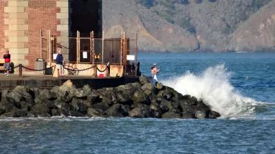
Bay Area's First Climate Adaptation Project Could Be a North Bay Highway
State Route 37 is a vital highway connecting four North Bay counties plagued by two unrelated problems: chronic flooding during high tides and traffic congestion. Fixing the problem will set a precedent for Bay Area climate adaptation.
An In-Depth Look at Sea Level Rise in the San Francisco Bay Area
The San Francisco Chronicle gives feature-length, in-depth treatment to the looming dangers of sea level rise, which are more likely to encroach on the built and natural environments of the Bay Area with every passing year.
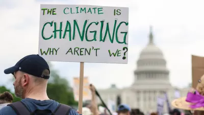
How Cities Can Curb Climate Change and Protect Vulnerable Residents
A new U.N. report urges cities to upgrade their infrastructure to bolster climate resilience and build more sustainable, climate-friendly places.

Maui's Vacation Rental Debate Turns Ugly
Verbal attacks, misinformation campaigns and fistfights plague a high-stakes debate to convert thousands of vacation rentals into long-term housing.

Planetizen Federal Action Tracker
A weekly monitor of how Trump’s orders and actions are impacting planners and planning in America.

Chicago’s Ghost Rails
Just beneath the surface of the modern city lie the remnants of its expansive early 20th-century streetcar system.

Bend, Oregon Zoning Reforms Prioritize Small-Scale Housing
The city altered its zoning code to allow multi-family housing and eliminated parking mandates citywide.

Amtrak Cutting Jobs, Funding to High-Speed Rail
The agency plans to cut 10 percent of its workforce and has confirmed it will not fund new high-speed rail projects.

LA Denies Basic Services to Unhoused Residents
The city has repeatedly failed to respond to requests for trash pickup at encampment sites, and eliminated a program that provided mobile showers and toilets.
Urban Design for Planners 1: Software Tools
This six-course series explores essential urban design concepts using open source software and equips planners with the tools they need to participate fully in the urban design process.
Planning for Universal Design
Learn the tools for implementing Universal Design in planning regulations.
planning NEXT
Appalachian Highlands Housing Partners
Mpact (founded as Rail~Volution)
City of Camden Redevelopment Agency
City of Astoria
City of Portland
City of Laramie